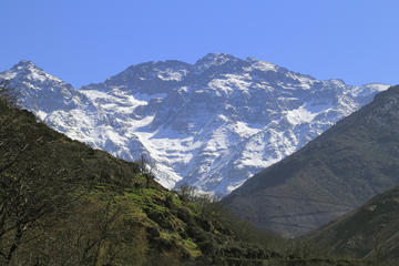
Mount Toubkal
TIME : 2016/2/22 12:03:48

Mount Toubkal
When you think of the Sahara, Northern Africa, or the sunny Moroccan plains, things like snow, ice, and crampons usually aren’t part of the picture. When climbing Mount Toubkal, however, conditions quickly go from hot to brisk, mountainside cold. Towering 13,751 feet above sea level, Mount Toubkhal is not only the highest mountain in central Morocco, but also the highest in the Atlas Range and all of Northern Africa. It’s a trail that’s accessible all year round to a wide range of hikers, and is more of a long, very steep stroll as opposed to a technical climb.
Trips begin from the town of Imlil about an hour south of Marrakech, where temperatures can still be blazingly hot despite the hillside perch. By the end of the first day of walking, however, the trail levels out at Toukbal Refuge near 10,000 feet elevation, where the air is suddenly crisp, cool, and a welcome break from the heat. Reaching the summit means rising early—often well before dawn—for the final, 3,000 foot vertical climb on a steep, scree-laden slope. Going up is often easier than down, though the view from the top is more than worth the six hour round trip climb. Finally, while climbing the mountain in two days is possible, most hikers break the journey up into a slower, three day climb.
Practical Info
The drive from Marrakech to the base camp at Imlil takes about an hour and 15 minutes. November-May can have winter conditions where ice axe and crampons are required, though the route is still a straightforward walk as opposed to climbing with ropes.
