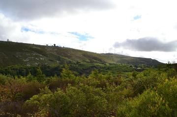
Montejunto Mountain
TIME : 2016/2/22 13:51:21

Montejunto Mountain
Standing at 666 meters (2,185 feet), the rocky peak of Montejunto sits north of Lisbon and is one of Portugal’s 30 protected landscapes; as the highest point on the horizon, it has unsurpassed views from the Salvé Rainha Viewpoint. When the weather permits, it is possible to see the Berlengas Islands floating out to the west in the Atlantic, the renowned surfers’ paradise of Nazaré, and the River Tagus flood plains unfolding to the south. The lower flanks of Montejunto are intensely farmed, while higher up the hill is swathed in pine, chestnut and oak trees; its upper reaches of limestone rock are pockmarked with gorges, caves and underground caverns. Evidence of ancient settlement on the slopes of the mountain includes several pre-historic necropolises and the countryside is also dotted with cheery white-and-blue windmills. It is a magnet for climbers, hikers, cyclists and twitchers, who come to see the 75 bird species – some endangered – identified in the area.
On the trail up to the top of Montejunto lie the photogenic ruins of a 12th-century Dominican convent – possibly the oldest in Portugal – side by side with the Chapel of Our Lady of the Snows, still intact and with parts dating back to the 13th century. Combine a day trip to Montejunto with a tour of the 18th-century, Baroque-style Real Fábrica do Gelo (ice factory) at Quinta da Serra, which was operated by friars from the convent and supplied ice to the royal palaces at Sintra and to Lisbon itself.
Practical Info
65.5 km (41 miles) north of Lisbon. Best accessible by car along the busy A1, with the journey taking around 75 minutes.
