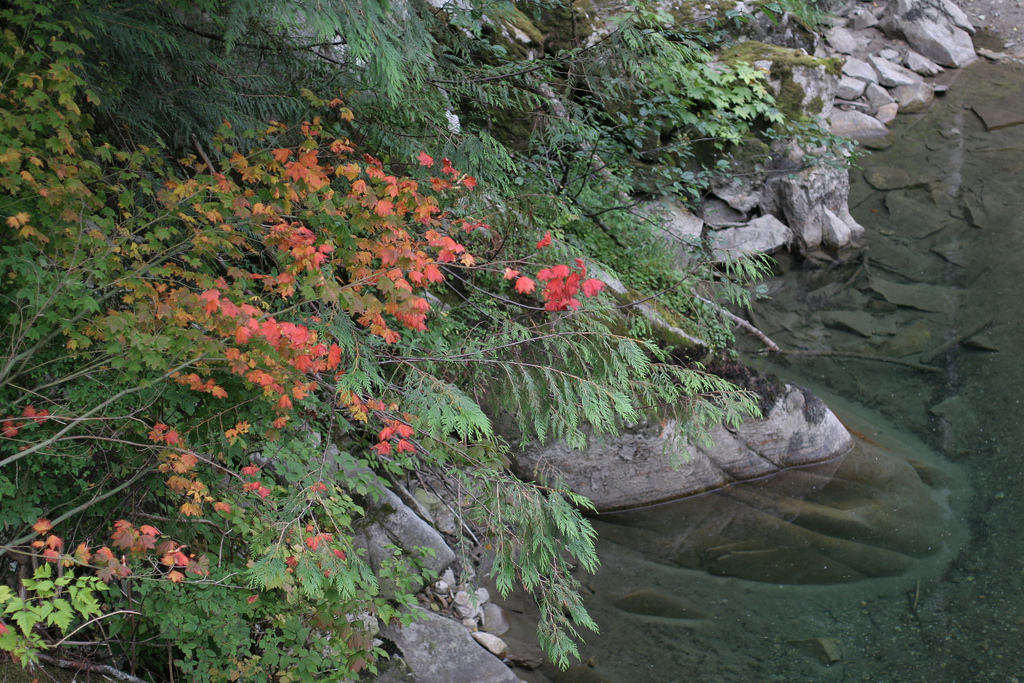
Early fall colors while hiking along the Middle Fork of the Snoqualmie River. Photo © Mark J. Handel, licensed Creative Commons Attribution.
From the Middle Fork trailhead, the trail quickly crosses the river on Gateway Bridge, one of the most beautiful backcountry bridges in the region. The trail runs along the river beneath a wall of granite with views up to the massive wall of Mount Garfield. It then enters the forest and moves away from the river, beneath the large wall of Stegosaurus Butte visible through the trees (0.6 mile). Occasionally the trail utilizes an old railroad grade built to haul out the massive timber logged from the valley. The trail is never steep—hikers of all abilities will have no difficulties. In recent years, the Forest Service has invested considerable resources into improving the trail. Numerous wooden structures, like bridges, boardwalks, and turnpikes, are evidence of the hard work put into this beloved trail.
After crossing the small stream from Nine Hour Lake (2.1 miles), the trail finally revisits the riverbanks (3.0 miles). There are several good sites for a rest and picnic in the next quarter mile. If you’re not committed to the entire hike, this is an ideal place to turn around. Beyond this point, Middle Fork Trail meanders through stands of old-growth western hemlock and Douglas fir. This is a wild stretch of trail—elk and bear encounters are not uncommon. A large bridge crosses Cripple Creek as it cascades over a series of enormous boulders (4.6 miles). The hike ends at the third large bridge of the day. Turn left at the trail’s first junction—a sign points left to Dingford Creek and Middle Fork Road. An impressive wooden bridge spans the Middle Fork Snoqualmie River as it roars over a series of large rapids. This is the recommended turnaround point.
Middle Fork Trail continues on past Dingford Creek to Goldmyer Hot Springs (9.7 miles). Goldmyer Hot Springs is a welcome respite in the middle of the woods and features several pools alongside Burnt Boot Creek. The springs are managed by Northwest Wilderness Programs; reservations are recommended and can be made by calling 206/789-5631.
From Seattle, drive east on I-90 to Exit 34. Turn left onto 468th Avenue North and drive 0.6 mile to Southeast Middle Fork Road. Turn right and drive 2.2 miles (via the left fork in the road) to a stop sign at Valley Camp. Turn left on Southeast Middle Fork Road, which becomes Forest Service Road 56. This road is surfaced with gravel and although it is marred by potholes, it is rarely inaccessible. At 12 miles on the right is signed Middle Fork trailhead with a large parking lot.
This trail is accessible year-round and is open to hikers, leashed dogs, and horseback riders—mountain bikers are not allowed. A federal Northwest Forest Pass is required to park here. For a map of Mount Baker–Snoqualmie National Forest, contact the Outdoor Recreation Information Center at the downtown Seattle REI. For topographic maps, ask Green Trails for No. 174, Mount Si, and No. 175, Skykomish, or ask the USGS for Lake Phillipa and Snoqualmie Lake. For more information, contact Mount Baker–Snoqualmie National Forest, North Bend Ranger Station, 42404 SE North Bend Way, North Bend, WA 98045, 425/888-1421.
Excerpted from the Third Edition of Moon Take a Hike Seattle.