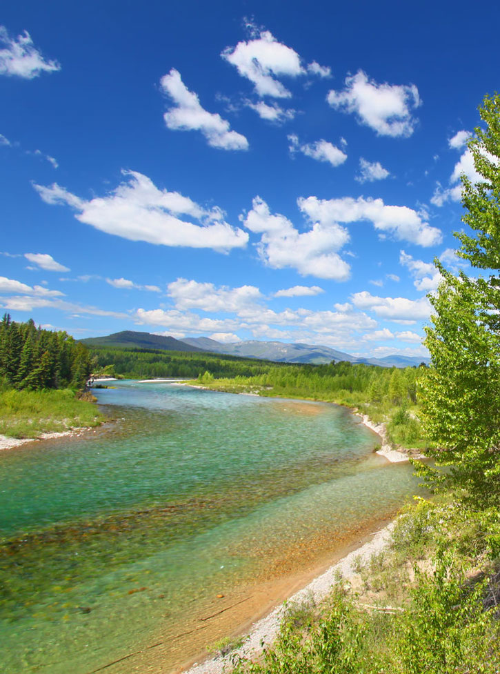
Along the north fork of the Flathead River. Photo © Jason Ross/123rf.
Open year-round, the Outside North Fork Road is the easier drive of the two dirt and gravel access roads. Although the road running from Columbia Falls to the Canadian border is two lanes wide, be prepared for washboards, potholes, ruts, dust in summer, slush or mud in fall or spring, and ice in winter. Recently, the section between Camas Road and Home Ranch Bottoms saw improvements with grading, gravel, and dust inhibitors.
Locals refer to this road as simply the North Fork, dropping the “Outside,” for it is the valley’s main gateway. Every few years, clamor arises about paving the North Fork, which many locals oppose because pavement would change the valley’s nature. The North Fork Road is intermittently plowed in winter as far as the Canadian border, but do not attempt it without good snow tires. Carry chains and emergency supplies in the car.
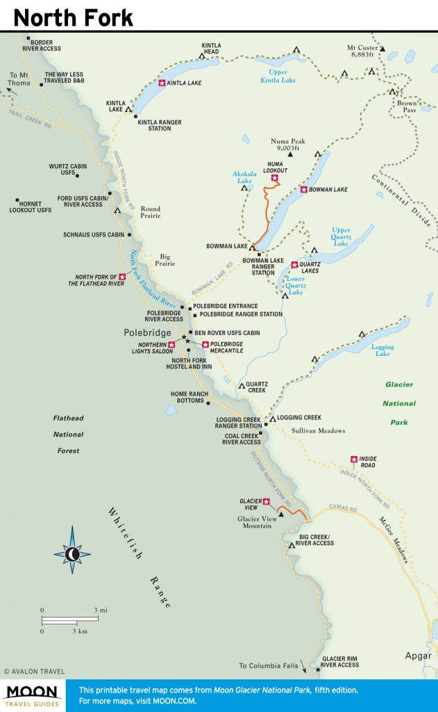
From Columbia Falls, the North Fork Road leaves pavement just past Blankenship Road and follows the North Fork River for 13 miles. After a junction with the paved Camas Road, an alternate access from Apgar, the road passes a few small bucolic ranches whose pastures provide browse for cows and wild elk herds. Six miles of pavement reappears at Home Ranch Bottoms, where cattle walk the road; drive with caution. At 32 miles and a little over one hour’s drive, the road meets Polebridge Loop—the cutoff to the Merc, Inside North Fork Road, Polebridge entrance to Glacier Park, and Bowman and Kintla Lakes. Hand-painted signs warn drivers entering town: “Slow Down, People Breathing.” Respect residents; speed kicks up a tremendous amount of dust in summer.
From the Polebridge junction, the road continues 22 more miles north toward Canada—another hour’s drive. It accesses the upper Whitefish Range trailheads, North Fork River, and Forest Service cabins. Although drivers used to cross into Canada, the Canadian government closed the Trail Creek port of entry.

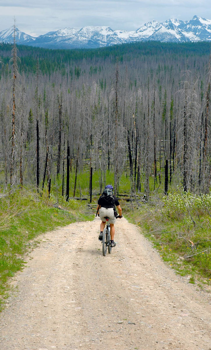
The Inside Road attracts adventurers by car and by mountain bike. Photo © Becky Lomax.
Not for everyone, the dirt Inside North Fork Road throws precipitous drops, curves, and climbs at drivers, but it’s only open late May-October, with sections often closed due to flooding. Monster potholes and washboards are commonplace; spaces wide enough for two vehicles to pass are rare. You’re definitely off the beaten path on this bumpy trek, where speeds top out at 20 mph, and two hours can be required to drive nearly 30 miles. (Longer with stops.) Marked as Glacier Route 7 on some maps and known as simply the “Inside Road” to locals, the road requires high-clearance vehicles. Big RV rigs have trouble, and it’s a rough ride for a trailer. Check with the park website, Apgar Visitor Center, or Polebridge Ranger Station for current conditions before embarking on the Inside Road.

North Fork
As of 2014, drivers can explore portions of the road, but not complete the 29-mile link to Polebridge. Due to recurring flood damage, the park service has closed the segment between Camus and Logging Creeks, pending engineering studies and potential reconstruction. Vehicles will be unable to drive the 53-mile loop connecting the Inside North Fork, Outside North Fork, and Camas Roads until road repairs are completed. However, mountain bikers can ride the complete loop, but may need to contend with downed trees in the sections closed to cars.
From the south, you can explore the Inside Road beginning at Fish Creek Campground. The road climbs through the 2003 Robert Fire. Atop the ridge, look for peekaboo views of McGee Meadows, a good wildlife-watching spot if you can squeeze your vehicle off the road and tolerate swarms of mosquitoes. Then compare fire regrowth as you drive through the 2001 Moose Fire to Camas Creek at 6.5 miles.
In the section closed to vehicles, cyclists can continue past Camas Creek to drop down the steep Anaconda Hill (12.5 miles north of Fish Creek). The road bisects Sullivan Meadows, famous for Glacier’s wolves, before reaching Logging Creek at 17.5 miles.
From the Polebridge entrance station, vehicles can go north or south on the Inside Road. Travel south to reach two small campgrounds—Quartz Creek in 8 miles and Logging Creek in 10.5 miles—and the trailhead to Logging Lake. Vehicles can also drive north on the Inside Road to Bowman Lake or Kintla Lake. A few minutes north of the Polebridge Ranger Station, the curvy Bowman Lake road turns off, a six-mile (25-minute) snakelike drive eastward up the valley. Continuing northward toward Kintla, the Inside Road crosses Big Prairie, the largest of the North Fork’s unique grasslands. Round Prairie follows at one-third the size. The road reenters the forest and passes through the 2003 Wedge Canyon Fire zone before deadending at Kintla Lake, 14 miles north of the North Fork entrance station.
Excerpted from the Fifth Edition of Moon Glacier National Park.