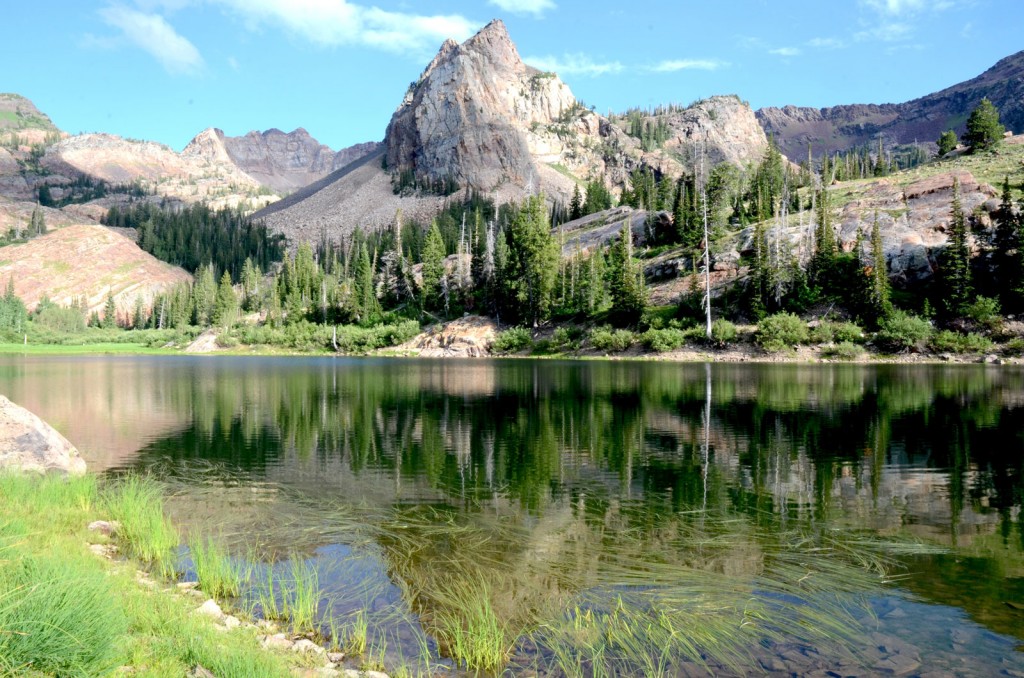
Sundial Peak reflected in Lake Blanche. Photo © Mike Matson.
From the Mill B South Fork (S Curve) parking lot walk east along a paved trail next to Big Cottonwood Creek. Turn right at 0.25 mile where the Mill B South Fork joins Big Cottonwood Creek and the rocky Lake Blanche Trail branches off to the right side of the pavement. If you cross the bridge on the paved trail, you’ve missed the turn.
The Lake Blanche Trail crosses the creek at 0.4 mile and climbs a few short switchbacks away from the water to enter the Twin Peaks Wilderness Area. The trail remains on the east side of the creek for the rest of the hike. Salmonberries grow close to the water, and the forest starts to give way to open meadows at about 1.5 miles. Views back down the canyon begin to open up at about 1.7 miles and continue to improve as you progress toward the lake. The meadows are filled with Indian paintbrush, purple aster, and blue flax wildflowers. At 2.1 miles the trail switchbacks up the left side of the canyon across crushed gray rock. The switchbacks go through the edge of the boulder field at 2.6 miles before climbing the last 0.25 mile to the lake.
Orange, glacier-polished rocks that glow warmly in the afternoon sun surround Lake Blanche. The uniquely shaped Sundial Peak is reflected on the water’s surface when it’s calm. It’s a landscape photographer’s dream. But you don’t need a camera to appreciate this special spot. Soak in the scene before returning down the trail the way you came.
Lakes Florence and Lillian aren’t visible when you reach Lake Blanche. These two lakes are actually west of Lake Blanche about 200 yards down from the old dam on the lake’s west end; they can be reached by hiking from the dam.
From Salt Lake City drive east on I-80 for 5 miles and take Exit 128 for I-215 South. Continue 6 miles and take Exit 6 for 6200 South. Turn left at the light at the bottom of the off-ramp and drive 1.7 miles south on 6200 South/Wasatch Boulevard. Turn left at the light and enter the mouth of Big Cottonwood Canyon. Continue up Big Cottonwood Canyon Road for 4.4 miles to the Mill B South/Lake Blanche trailhead on the right side of the road.
There is no fee. Big Cottonwood Canyon is a watershed and dogs are not allowed. Maps are available at the Public Lands Information Center, 3285 East 3300 South (inside REI), Salt Lake City, UT 84109, 801/466-6411. For more information, contact Salt Lake City Ranger District, Uinta-Wasatch-Cache National Forest, 125 South State Street, Salt Lake City, UT 84138, 801/236-3400.
Excerpted from the First Edition of Moon Take a Hike Salt Lake City.