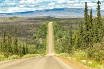
Dalton Highway
TIME : 2016/2/22 16:51:38

Dalton Highway
The Dalton Highway runs for 414 miles to Alaska’s northernmost mountains in the Brooks Range and nearly all the way out to the Arctic Ocean. Running through valleys surrounded by jagged peaks, the highway connects Interior Alaska to the Prudhoe Bay oil fields and is technically part of the northernmost highway in the U.S. Also one of the most remote, the Dalton Highway parallels the Trans-Alaska Pipeline. Visitors who take the drive themselves will need to note that much of the road is still mostly gravel. Unless you’ve appeared on Ice Road Truckers, you might want to skip the ride in winter.
Public access ends at the small town of Deadhorse, just before the Arctic Ocean, and if you want to reach those last 8 miles of private road out to the coast, it’s possible to join private tours from Deadhorse. At the Coldfoot truck stop, 250 miles north of Fairbanks, the Arctic Interagency Visitor Center gives details on road and backcountry conditions along the Dalton Highway, as well as information on recent wildlife spottings of the likes of grizzlies, black bears, and dall sheep. There’s also a picnic area and sign showing where the road crosses the Arctic Circle.
Practical Info
If you’re driving, bring a spare tire or two. Keep your headlights on, and make way for trucks. To ride the full length of the highway it takes about 2 days of traveling at 40 mph. There are a few lodges and places to camp along the way.
