Cheakmus River
TIME : 2016/2/22 10:06:39

Cheakmus River
The Cheakamus River flows roughly parallel to the Sea-to-Sky Highway between Whistler and Vancouver, but its path is far different than the paved four-lane highway. Much of the river flows through Cheakamus Canyon, where plenty of exciting whitewater rapids and one sizeable waterfall make the river a popular rafting and kayaking route. None of the rapids are too challenging, so the trip is considered suitable for kids and parents alike.
The river is also a favorite spot for local fisherman. Coho and Chum salmon swim upriver between September and December; Bull, Rainbow and Cutthroat trout fishing is strong from late autumn until early spring; and Steelhead season typically lasts from March until May.
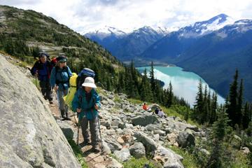
The Cheakamus River descends from Cheakamus Lake, located in Garibaldi Park and just behind Whistler Mountain. It’s only a 1.8-mile (3-km), one-hr hike from the trailhead near Whistler’s Function Junction to the lake, but it’s a very scenic trail that winds through old-growth forest before arriving at the emerald-colored lake. It’s an additional 2.5-mile (4-km) hike to the opposite end of the lake; however, the views improve every step of the way. There are backcountry tent sites right on the lakeshore, too, for hikers hoping to spend the night.
Practical Info
The Cheakamus River is 44 miles (70 km) long. Its source is on Outlier Peak, in Garibaldi Provincial Park, and it flows south through Cheakamus and Daisy lakes before flowing into the Squamish River just before the Squamish River flows into Howe Sound.
