-
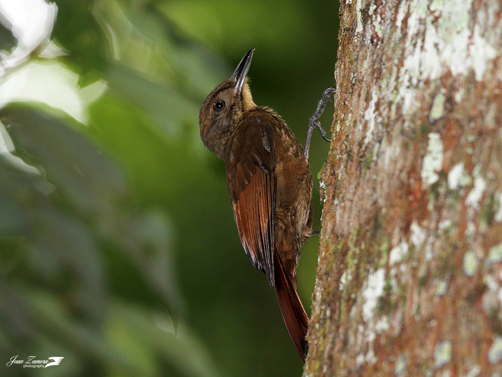 San Isidro de El General in South-Central Costa Rica
A plain-brown woodcreeper (Dendrocincla fuliginosa) in Los Cusingos Bird Sanctuary. Photo © Juan Zamora, licensed Creative Commons Attribution.
San Isidro de El GeneralSan Isidro, regional capital of the Valle de El General, is an agricultural market town, gateway to Parque Nacional Chirripó
-
 Visiting the Orosi-Cachí Valley in the Central Highlands
The ruins of Nuestra Señora de la Limpia Concepción, built out of limestone between 1681 and 1693. Photo © Raúl José, licensed Creative Commons Attribution No-Derivatives.
Orosi-Cachí ValleySouth of Paraíso, Highway 224 drops steeply into the Valle de Orosi, a self-contained world dedicated t
-
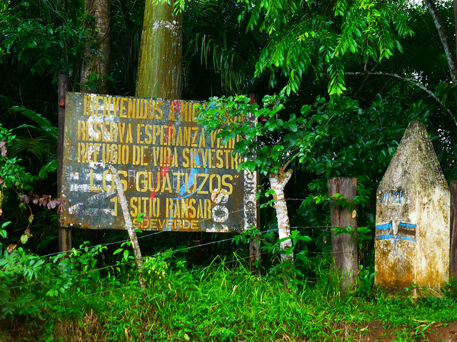 Crossing the Border into Nicaragua or Panamá from Costa Rica
A sign at the border welcoming travelers to Nicaragua. Photo © F Delventhal, licensed Creative Commons Attribution.
You cannot cross into Nicaragua or Panamá with a rental car; you can only do so with your own vehicle. If it has Costa Rican plates, you’ll need a special permit from the Registro Na
-
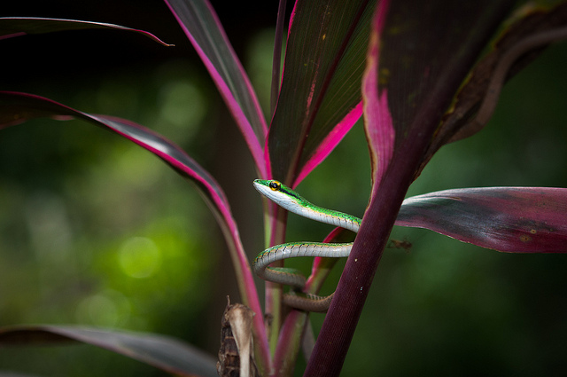 Costa Rica Travel Essentials: Insects, Infection, and Other Health Concerns
The green parrot snake, native to Costa Rica. While their venom is too weak to harm a human, their bite can cause a bacterial infection. Photo © Barb Ignatius, licensed Creative Commons Attribution.
Spiders, scorpions, no-see-ums—it’s enough to give you the willies! Check your bedding before crawl
-
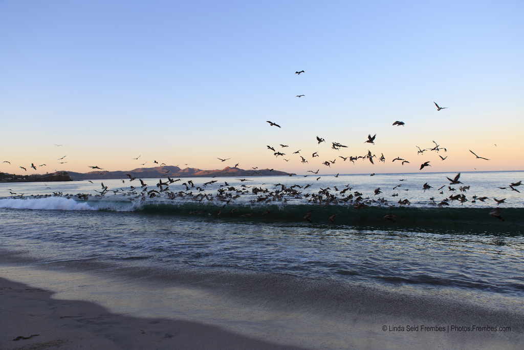 Planning a Trip to Guanacaste, Costa Rica's Wild West
Morning at Playa Flamingo. Photo © Linda Seid Frembes, licensed Creative Commons Attribution No-Derivatives.
Guanacaste has been called Costa Rica’s “Wild West.” The name Guanacaste derives from quahnacaztlan, a word from an indigenous language meaning “place near the ear trees,” for the tall
-
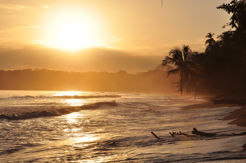 Discover Costa Rica's Caribbean Coast
A beautiful golden sunrise in Cahuita, Costa Rica. Photo © Armando Maynez, licensed Creative Commons Attribution.
Costa Rica’s Caribbean coast extends some 200 kilometers (120 miles) from Nicaragua to Panamá. The zone—wholly within Limón Province—is divided into two distinct regions.
North of
-
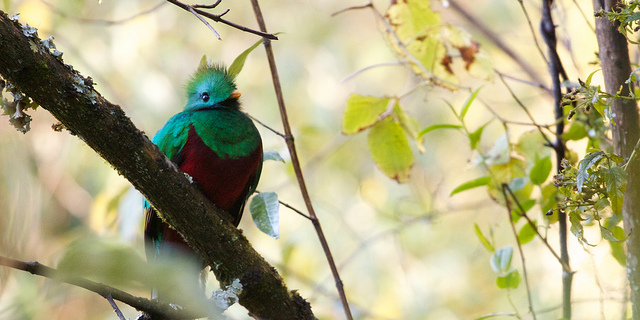 Visiting El Silencio de Los Ángeles Cloud Forest Reserve
The resplendent quetzal is common in the area. Photo © Matt MacGillivray, licensed Creative Commons Attribution.
This reserve is an extension of the 800-hectare (2,000-acre) Los Ángeles Cloud Forest Reserve & Adventure Park (8am-4pm daily); it begins at 700 meters (2,300 feet) elevation a
-
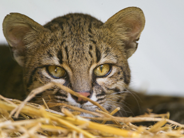 Visiting Cañas in Guanacaste, Costa Rica
Oncilla (also known as tigrillo or tiger cats) are one of the species cared for at Centro de Rescate Las Pumas. Photo © Tambako the Jaguar, licensed Creative Commons Attribution No-Derivatives.
CañasCañas is a modest-sized town and a pivotal point for exploring Parque Nacional Palo Verde (we
-
 Costa Rica's Parque Nacional Volcán Irazú
The water in the Diego de la Heya crater can range from pea-green to rust-red. Photo © Ben Haeringer, licensed Creative Commons Attribution No-Derivatives.
The slopes north of Cartago rise gradually to the summit of Volcán Irazú; it’s a 21-kilometer (13-mile) journey to the entrance to Parque
-
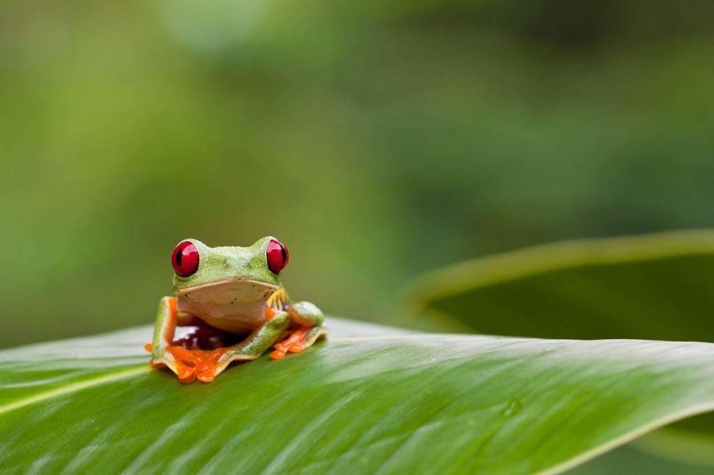 Discover Costa Rica
The red-eyed tree frog is practically an icon of Costa Rica’s lush rainforest. Photo © Peter Wollinga/123rf.
On my first visit to Costa Rica, I performed yoga in a crisply cool cloud forest with accommodations in a Swiss-style hotel amid the pines. The next day I participated in dawn calist
-
 Tárcoles, Costa Rica: Crocodile Safaris, Birding Tours, and More
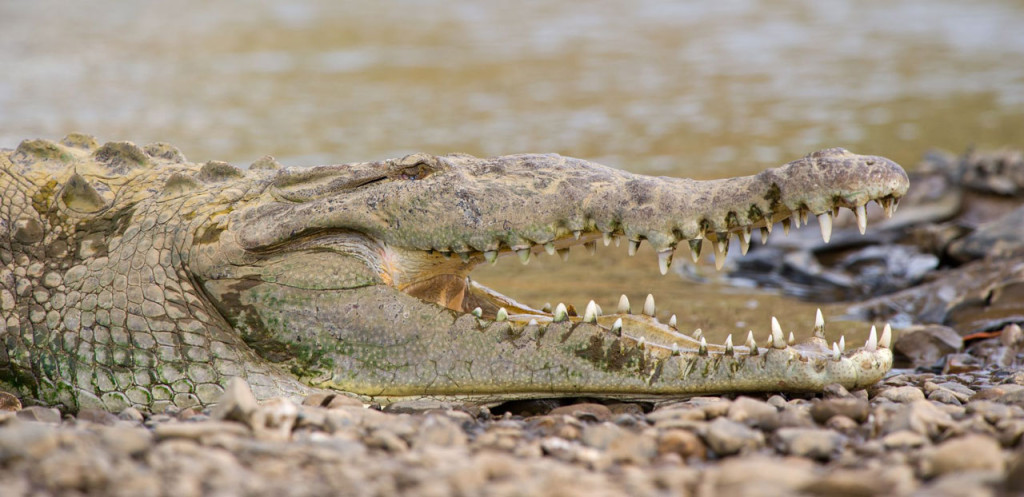
An American Crocodile suns itself on the shore of the Río Tárcoles. Photo © Eduardo Rivero/123rf.
Twenty-five kilometers (16 miles) south of Orotina, Highway 34 crosses the Río Tárcoles. The bridge over the river is the easiest place in the country to spot crocodiles, which bask on the mud ba
-
 Costa Rica's Parque Nacional Palo Verde in the Tempisque Basin
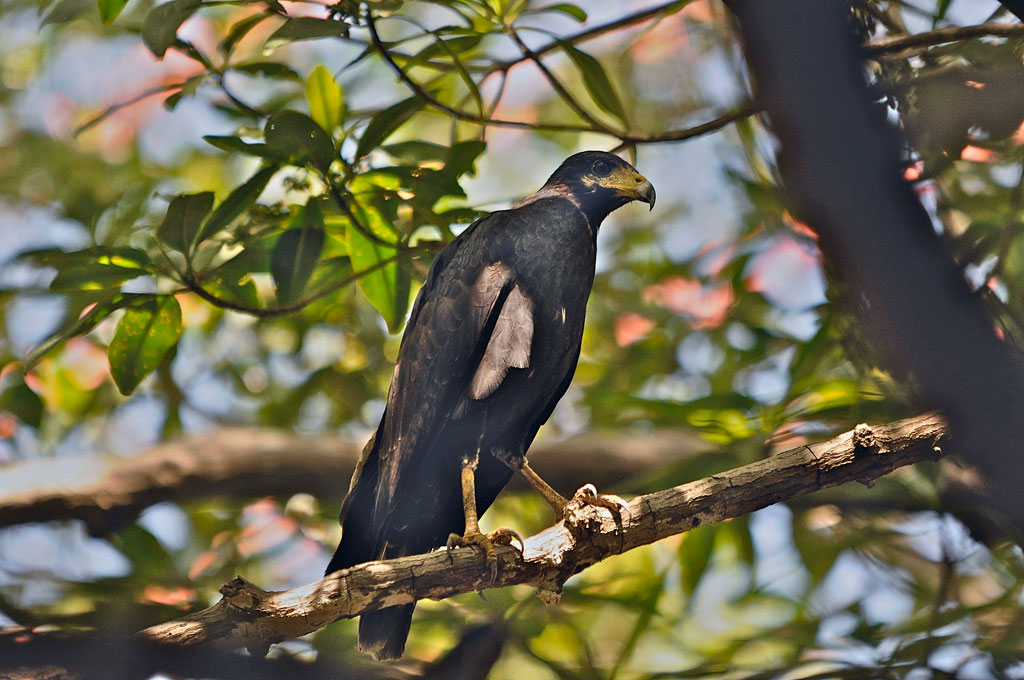
A Mangrove Black Hawk photographed on the banks of the Río Tempisque. Photo © Brian Ralphs licensed, Creative Commons Attribution.
Guanacaste and the NorthwestParque Nacional Palo Verde ($10), 28 kilometers (17 miles) south of Bagaces, protects 13,058 hectares (32,267 acres) of floodplain, ma
-
 Nightlife in San José, Costa Rica
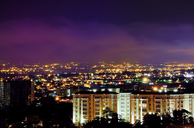
Explore the nightlife in San José, Costa Rica. Photo © Armando Maynez, licensed Creative Commons Attribution.
Whatever your nocturnal craving, San José has something to please. The Tico Times and the “Viva” section of La Nación have listings of what’s on in San José. Also pick up a copy of GAM Cu
-
 Costa Rica's Caribbean Coast: Playa Cocles to Punta Uva
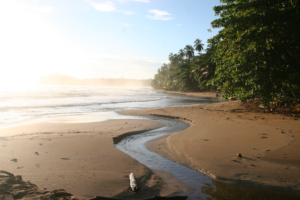
The beach at Punta Uva. Photo © Wim de Jong, licensed Creative Commons Attribution.
South of Puerto Viejo, the paved road runs via Punta Cocles and Punta Uva to Manzanillo, a fishing village at the end of the road, 13 kilometers (8 miles) southeast of Puerto Viejo. Coral-colored Playa Cocles
-
 San Gerardo de Dota and Parque Nacional Los Quetzales
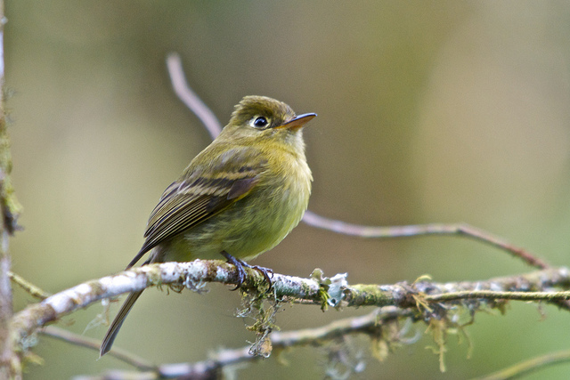
A yellowish flycatcher photographed at the Savegre Reserve. Photo © Brian Ralphs, licensed Creative Commons Attribution.
San Gerardo de Dota, nine kilometers (5.5 miles) west and sharply downhill from the Pan-American Highway at Kilometer 80, is an exquisite hamlet tucked at the base of a nar
-
 Visiting Puerto Viejo on Costa Rica's Caribbean Coast
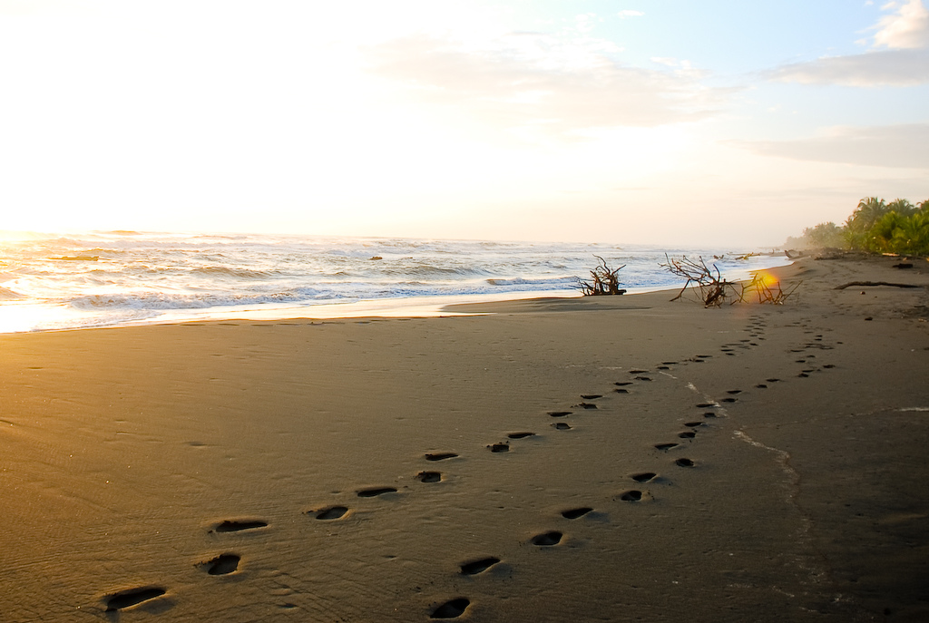
Stopping at the beach in Puerto Viejo while on a cacao tour. Photo © Everjean, licensed Creative Commons Attribution.
About 13 kilometers (8 miles) south of Cahuita, the road forks just after Hone Creek (also spelled Home Creek). The main road turns east toward Bribrí; a spur leads three kilo
-
 Visiting Playa Matapalo on Costa Rica's Pacific Coast
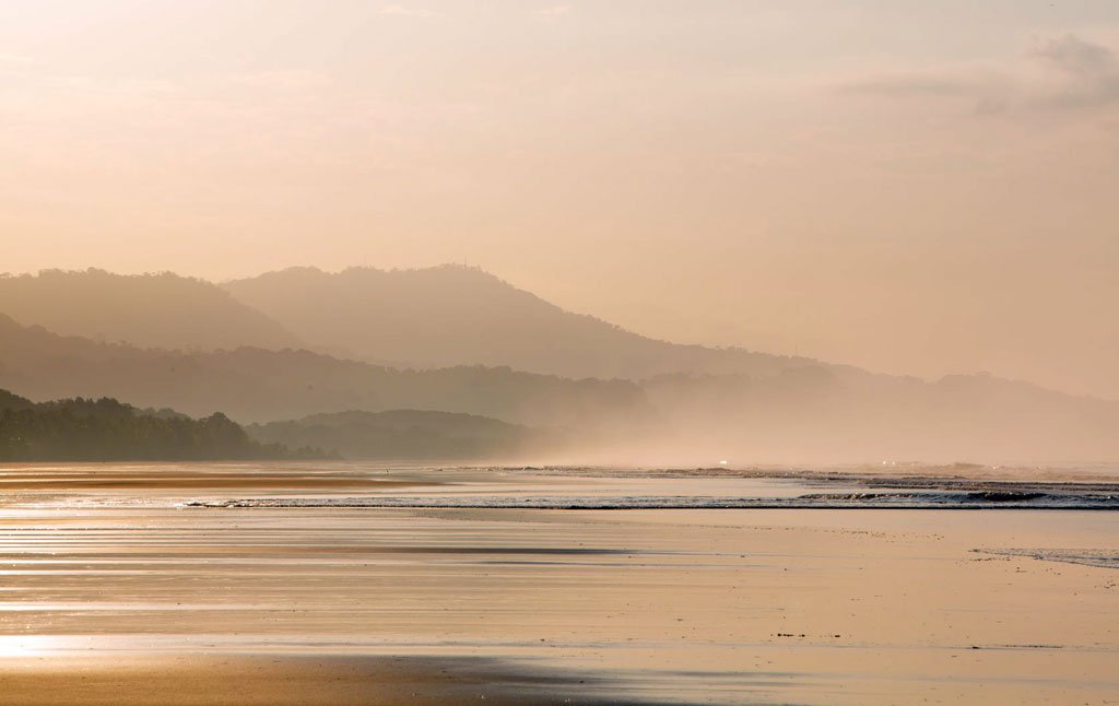
A mystical sunrise at Playa Matapalo. Photo © piccaya/123rf.
Playa Matapalo, five kilometers (3 miles) south of Savegre, is a beautiful gray-sand beach two kilometers (1.2 miles) east of the coast road; the turnoff is in the hamlet of Matapalo. The surf kicks in here (swimmers should beware o
-
 Cresting the Cerro de la Muerte from Cartago
South of Cartago, the Pan-American Highway (Hwy. 2) begins a daunting ascent over the Talamanca Mountains, cresting the range at Cerro de la Muerte (Mountain of Death) at 3,491 meters (11,453 feet) before dropping down into the Valle de El General and the Pacific southwest. The vistas are staggeri
-
 Plan a trip to Manuel Antonio
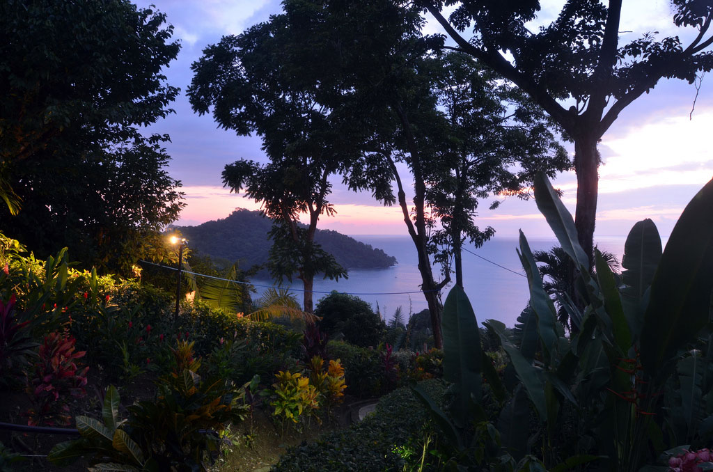
View of the ocean taken from Buena Vista Villas in Manuel Antonio. Photo © Beth Rankin, licensed Creative Commons Attribution.
Immediately southeast of Quepos, a road climbs sharply over the forested headland of Punta Quepos and snakes, dips, and rises south along a ridge for seven kilometers
-
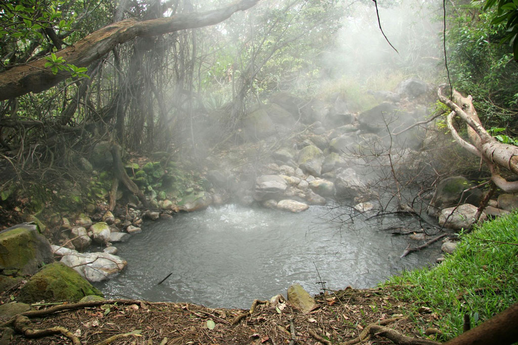 Parque Nacional Rincón de la Vieja in Guanacaste, Costa Rica
Steam rises from one of Parque Nacional Rincón de la Vieja’s geothermal springs. Photo © Brian Lasenby/123rf.
Guanacaste and the NorthwestParque Nacional Rincón de la Vieja, an active volcano in a period of relative calm, is the largest of five volcanoes that make up the Cordillera de G
Total
334 -travel
FirstPage PreviousPage NextPage LastPage CurrentPage:
14/17 20-travel/Page Goto:
 San Isidro de El General in South-Central Costa Rica
A plain-brown woodcreeper (Dendrocincla fuliginosa) in Los Cusingos Bird Sanctuary. Photo © Juan Zamora, licensed Creative Commons Attribution.
San Isidro de El GeneralSan Isidro, regional capital of the Valle de El General, is an agricultural market town, gateway to Parque Nacional Chirripó
 Visiting the Orosi-Cachí Valley in the Central Highlands
The ruins of Nuestra Señora de la Limpia Concepción, built out of limestone between 1681 and 1693. Photo © Raúl José, licensed Creative Commons Attribution No-Derivatives.
Orosi-Cachí ValleySouth of Paraíso, Highway 224 drops steeply into the Valle de Orosi, a self-contained world dedicated t
 Crossing the Border into Nicaragua or Panamá from Costa Rica
A sign at the border welcoming travelers to Nicaragua. Photo © F Delventhal, licensed Creative Commons Attribution.
You cannot cross into Nicaragua or Panamá with a rental car; you can only do so with your own vehicle. If it has Costa Rican plates, you’ll need a special permit from the Registro Na
 Costa Rica Travel Essentials: Insects, Infection, and Other Health Concerns
The green parrot snake, native to Costa Rica. While their venom is too weak to harm a human, their bite can cause a bacterial infection. Photo © Barb Ignatius, licensed Creative Commons Attribution.
Spiders, scorpions, no-see-ums—it’s enough to give you the willies! Check your bedding before crawl
 Planning a Trip to Guanacaste, Costa Rica's Wild West
Morning at Playa Flamingo. Photo © Linda Seid Frembes, licensed Creative Commons Attribution No-Derivatives.
Guanacaste has been called Costa Rica’s “Wild West.” The name Guanacaste derives from quahnacaztlan, a word from an indigenous language meaning “place near the ear trees,” for the tall
 Discover Costa Rica's Caribbean Coast
A beautiful golden sunrise in Cahuita, Costa Rica. Photo © Armando Maynez, licensed Creative Commons Attribution.
Costa Rica’s Caribbean coast extends some 200 kilometers (120 miles) from Nicaragua to Panamá. The zone—wholly within Limón Province—is divided into two distinct regions.
North of
 Visiting El Silencio de Los Ángeles Cloud Forest Reserve
The resplendent quetzal is common in the area. Photo © Matt MacGillivray, licensed Creative Commons Attribution.
This reserve is an extension of the 800-hectare (2,000-acre) Los Ángeles Cloud Forest Reserve & Adventure Park (8am-4pm daily); it begins at 700 meters (2,300 feet) elevation a
 Visiting Cañas in Guanacaste, Costa Rica
Oncilla (also known as tigrillo or tiger cats) are one of the species cared for at Centro de Rescate Las Pumas. Photo © Tambako the Jaguar, licensed Creative Commons Attribution No-Derivatives.
CañasCañas is a modest-sized town and a pivotal point for exploring Parque Nacional Palo Verde (we
 Costa Rica's Parque Nacional Volcán Irazú
The water in the Diego de la Heya crater can range from pea-green to rust-red. Photo © Ben Haeringer, licensed Creative Commons Attribution No-Derivatives.
The slopes north of Cartago rise gradually to the summit of Volcán Irazú; it’s a 21-kilometer (13-mile) journey to the entrance to Parque
 Discover Costa Rica
The red-eyed tree frog is practically an icon of Costa Rica’s lush rainforest. Photo © Peter Wollinga/123rf.
On my first visit to Costa Rica, I performed yoga in a crisply cool cloud forest with accommodations in a Swiss-style hotel amid the pines. The next day I participated in dawn calist
 Tárcoles, Costa Rica: Crocodile Safaris, Birding Tours, and More
An American Crocodile suns itself on the shore of the Río Tárcoles. Photo © Eduardo Rivero/123rf.
Twenty-five kilometers (16 miles) south of Orotina, Highway 34 crosses the Río Tárcoles. The bridge over the river is the easiest place in the country to spot crocodiles, which bask on the mud ba
 Costa Rica's Parque Nacional Palo Verde in the Tempisque Basin
A Mangrove Black Hawk photographed on the banks of the Río Tempisque. Photo © Brian Ralphs licensed, Creative Commons Attribution.
Guanacaste and the NorthwestParque Nacional Palo Verde ($10), 28 kilometers (17 miles) south of Bagaces, protects 13,058 hectares (32,267 acres) of floodplain, ma
 Nightlife in San José, Costa Rica
Explore the nightlife in San José, Costa Rica. Photo © Armando Maynez, licensed Creative Commons Attribution.
Whatever your nocturnal craving, San José has something to please. The Tico Times and the “Viva” section of La Nación have listings of what’s on in San José. Also pick up a copy of GAM Cu
 Costa Rica's Caribbean Coast: Playa Cocles to Punta Uva
The beach at Punta Uva. Photo © Wim de Jong, licensed Creative Commons Attribution.
South of Puerto Viejo, the paved road runs via Punta Cocles and Punta Uva to Manzanillo, a fishing village at the end of the road, 13 kilometers (8 miles) southeast of Puerto Viejo. Coral-colored Playa Cocles
 San Gerardo de Dota and Parque Nacional Los Quetzales
A yellowish flycatcher photographed at the Savegre Reserve. Photo © Brian Ralphs, licensed Creative Commons Attribution.
San Gerardo de Dota, nine kilometers (5.5 miles) west and sharply downhill from the Pan-American Highway at Kilometer 80, is an exquisite hamlet tucked at the base of a nar
 Visiting Puerto Viejo on Costa Rica's Caribbean Coast
Stopping at the beach in Puerto Viejo while on a cacao tour. Photo © Everjean, licensed Creative Commons Attribution.
About 13 kilometers (8 miles) south of Cahuita, the road forks just after Hone Creek (also spelled Home Creek). The main road turns east toward Bribrí; a spur leads three kilo
 Visiting Playa Matapalo on Costa Rica's Pacific Coast
A mystical sunrise at Playa Matapalo. Photo © piccaya/123rf.
Playa Matapalo, five kilometers (3 miles) south of Savegre, is a beautiful gray-sand beach two kilometers (1.2 miles) east of the coast road; the turnoff is in the hamlet of Matapalo. The surf kicks in here (swimmers should beware o
 Cresting the Cerro de la Muerte from Cartago
South of Cartago, the Pan-American Highway (Hwy. 2) begins a daunting ascent over the Talamanca Mountains, cresting the range at Cerro de la Muerte (Mountain of Death) at 3,491 meters (11,453 feet) before dropping down into the Valle de El General and the Pacific southwest. The vistas are staggeri
 Plan a trip to Manuel Antonio
View of the ocean taken from Buena Vista Villas in Manuel Antonio. Photo © Beth Rankin, licensed Creative Commons Attribution.
Immediately southeast of Quepos, a road climbs sharply over the forested headland of Punta Quepos and snakes, dips, and rises south along a ridge for seven kilometers
 Parque Nacional Rincón de la Vieja in Guanacaste, Costa Rica
Steam rises from one of Parque Nacional Rincón de la Vieja’s geothermal springs. Photo © Brian Lasenby/123rf.
Guanacaste and the NorthwestParque Nacional Rincón de la Vieja, an active volcano in a period of relative calm, is the largest of five volcanoes that make up the Cordillera de G