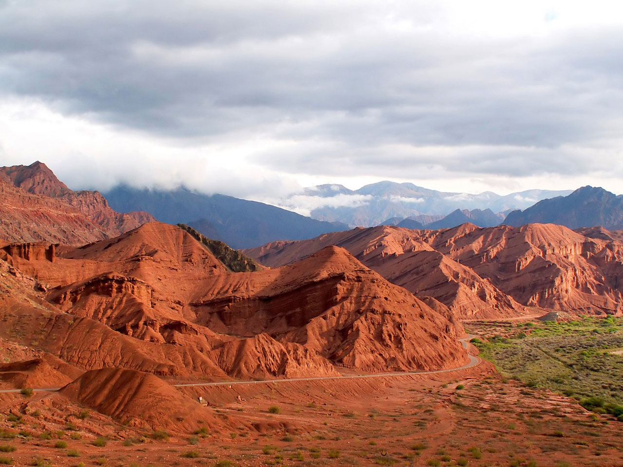
Argentina’s natural landscapes range from northeastern subtropical wetlands to the endless pampas grasslands, Andean uplands, and sprawling Patagonian steppes. Photo © Kamila Kowalska/123rf.
Stretching from the northern desert tropics through the temperate pampas grasslands to the subantarctic and rising from sea level to puna zones well above 4,000 meters, alpine fell fields, and continental glaciers, Argentina’s diverse geography contains almost every possible South American environment. With an area of about 2.8 million square kilometers (apart from its South Atlantic and Antarctic claims), Argentina is the world’s eighth-largest country, only slightly smaller than India. With an area of about 2.8 million square kilometers (apart from its South Atlantic and Antarctic claims), Argentina is the world’s eighth-largest country, only slightly smaller than India. From the tropical latitudes of the Bolivian border, around 22° south, it stretches more than 3,700 kilometers as the crow flies to almost exactly 55° south at the city of Ushuaia, on the Argentine side of Tierra del Fuego. It’s more than 1,300 kilometers across at its widest, in the north, but narrows to barely 400 kilometers at the tip.Most of Argentina is temperate lowlands, but its natural landscapes range from northeastern subtropical wetlands to the endless pampas grasslands, Andean uplands, and sprawling Patagonian steppes.
On the right bank of the Río de la Plata, the capital city of Buenos Aires sits atop the coastal margin of the flat, fertile, sedimentary pampas, whose beef and grain exports made Argentina a wealthy country throughout much of the 19th and 20th centuries. Receiving up to 1,200 millimeters of rainfall per annum, Buenos Aires Province’s easterly pampas are lush, green, and vulnerable to flooding; rainfall diminishes as the landscape stretches westward into Córdoba and La Pampa Provinces, where it is nearly desert.
Argentina’s most imposing physiographic feature is the longitudinal Andean range that runs from its northern borders with Chile and Bolivia to southernmost Patagonia, where it gradually disappears beneath the oceans. The highest point in the Americas is Cerro Aconcagua’s 6,962-meter summit, west of the city of Mendoza, but much of the northern Andes and altiplano (high steppe) or puna exceeds 4,000 meters. The southern Patagonian Andes are not so high but have glaciated peaks because of their higher latitude.
In addition to the Andes, there are several lesser ranges. The interior of northern Misiones Province is undulating hill country that rarely exceeds 600 meters. Near the country’s geographical center, most of the rolling Sierras de Córdoba top out around 1,500 meters, though the highest peaks fall just short of 3,000 meters; the range extends into neighboring San Luis Province. In southern Buenos Aires Province, the Tandil and Ventania ranges lie mostly below 1,000 meters but still offer relief from the otherwise numbingly flat pampas.
In Jujuy, Salta, and other northwestern provinces, sparse pasture grasses and prostrate shrubs cover the broad level areas of the highaltitude puna, between the soaring volcanoes along the Chilean and Bolivian borders. In Patagonia’s high latitudes, similar grasses and shrubs punctuate the meseta between the Atlantic coast and the Andean foothills to the west.
The Río de la Plata, misleadingly glossed into English as the River Plate, is one of the world’s great river systems, approaching the Amazon, the Nile, and the Mississippi in terms of length, width, and flow. Originating in the Bolivian altiplano, draining an area of more than 3.1 million square kilometers, it is in reality an estuary at the confluence of the Río Paraná (3,945 kilometers long) and the Río Uruguay (1,650 kilometers long).
Its delta, northwest of Buenos Aires proper, is a series of islands in a maze of muddy channels whose sedimentary surface is largely covered by dense gallery forest. United, the waters of the Paraná and Uruguay carry sediments far out into the South Atlantic.
In the west, descending from the Andes, rushing rivers create recreational rafting runs and water to irrigate the vineyards of Mendoza Province and other wine-growing areas. Some of these reverse direction to flow through gaps into the Pacific on the Chilean side, while others traverse the Patagonian steppe to reach the Atlantic.
Between the Río Paraná and the Río Uruguay, the Mesopotamian lowland provinces of Entre Ríos, Corrientes, and Misiones are home to lush gallery forests along the rivers and shallow, biologically rich wetlands between them. The most notable, one of the country’s most spectacular attractions, is Corrientes’s Esteros del Iberá.
Argentina is famous for its southern lakes district, where the melting ice of Pleistocene glaciers has left a legacy of indigo-filled troughs. Even in the desert north, though, there are surprises like Laguna Pozuelos, which is home to a wealth of birdlife that includes flamingos and giant coots.
Excerpted from the Third Edition of Moon Argentina.