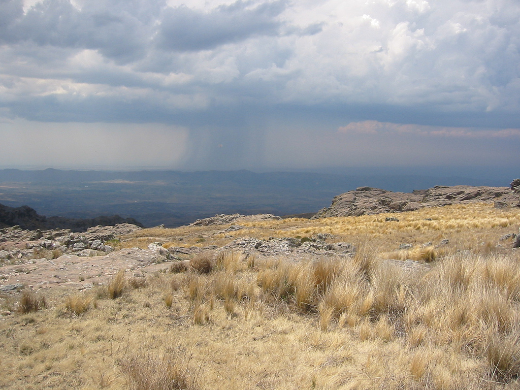
Rain in the distance viewed from Parque Nacional Quebrada del Condorito. Photo © Tjeerd Wiersma, licensed Creative Commons Attribution.
The world’s most famous carrion carnivore, the majestic Andean condor, reaches its easternmost range in the Altas Cumbres (High Summits) of the Sierras de Córdoba, where it lends its name to the area’s only national park. Because of its year-round accessibility, the park makes an ideal excursion from Villa Carlos Paz or even the provincial capital, or a stopover en route to or from San Luis Province.Quebrada del Condorito is 55 kilometers southwest of Villa Carlos Paz and 90 kilometers southwest of Córdoba via RP 20, the Camino Altas Cumbres, which continues west to Mina Clavero and San Luis. Comprising some 37,000 hectares of rolling high terrain cut by eastward-draining streams on the Pampa de Achala, up to 2,300 meters above sea level, the park lies mostly south of the highway.
The average annual temperature is about 8°C, but at these altitudes winter temperatures can fall to ‑25°C. Most precipitation falls in spring and summer (Nov.–Mar.), so it snows only three to five times per year.
Most of the park consists of high-altitude grasslands where high evaporation discourages trees and even shrubs. The slopes of its sheltered, well-watered canyons, though, support dwarf forests of tabaquillo and maitén, along with ferns and a host of endemics.
Its signature animal, of course, is the condor, which soars overhead and breeds on rocky outcrops in the canyon that bears its name. It is also home to mammals like the puma and red fox and a host of other birds including the red-and-blackheaded turkey vultures. If hiking, watch carefully for the highly venomous pit viper yarará ñata; fortunately, most reptiles are harmless lizards.
The most accessible sight/activity is the nine-kilometer hike, a signed trail from Paraje La Pampilla, on the highway, to Balcón Norte, the Río Condorito Canyon’s northern overlook. Unlike most mountain trails, this one starts high and descends gradually, over undulating terrain, to the Quebrada’s edge.
The Quebrada itself is a V-shaped canyon, 800 meters deep, 1.5 kilometers wide, and about 12 kilometers long; a short lateral descends through scrub forest and ferns to an overlook for the condor nesting site—colloquially known as the Escuela de Vuelo (Flight School)—on the nearly vertical south-side walls.
Hiking the trail—really an abandoned road for most of its length—takes about 2–2.5 hours one-way; carry water and snacks. While the trail is well-signed and the weather is normally clear, fog banks can disrupt visibility. Bicycles are permitted in dry weather only.
The nearest hotels are in Villa Carlos Paz and Mina Clavero, both some distance from the park. Park rangers, though, will grant permission to camp at Cañada del Hospital, near the new visitors center; Pampa Pajosa, near Balcón Norte; and at Puesto Condorito, about 20 minutes across the Río Condorito. The latter involves a steep descent and river ford.
About nine kilometers before Paraje La Pampilla, the Fundación Cóndor has a respectable restaurant with standard Argentine food and regional specialties like locro. Campers must bring camp stoves—no fires are allowed within the park.
About two kilometers south of Paraje La Pampilla, rangers staff the new Centro de Visitantes, open 7 a.m.–8 p.m. daily. Nine kilometers east of La Pampilla, the Fundación Cóndor is a private foundation that also has a Córdoba office (José J. Díaz 1036, tel. 0351/464-6537, [email protected] or [email protected]).
The APN has its Intendencia in Villa Carlos Paz (Resistencia 30, tel. 03541/43-3371, [email protected]). There is still no entry fee, but this may change.
Contact travel agencies in Córdoba or the Fundación Cóndor for guided excursions. Otherwise, it’s possible to take Ciudad de Córdoba buses (tel. 0351/428-2811) from Córdoba to La Pampilla (about 1.5 hours) at 8:30 and 10:30 a.m. and 1:15, 4:45, 7:30, and 11:30 p.m.; return buses from Mina Clavero pass La Pampilla at 4:45 a.m. and 12:45, 4, 6:35, and 8:35 p.m. Schedules can change, though, so visitors should verify times. Buses from Córdoba can be caught about 50 minutes later in Villa Carlos Paz.
Excerpted from the Third Edition of Moon Argentina.