In 1991, U.S. businessman Douglas Tompkins and his wife, Kris McDivitt Tompkins, cashed out their equity from the Esprit and Patagonia clothing empires to purchase blocks of temperate rainforest to create the region’s largest destination in Parque Pumalín, a 317,000-hectare private nature reserve straddling the highway north of Chaitén.
Since then, says the New York Times, only General Pinochet’s name has appeared more in the Chilean press than Tompkins. He has even received death threats from ultranationalists who accuse him of trying to split the country in half. Tompkins has many Chilean supporters, though, and most criticisms are not so extreme.
Tompkins has allayed much of that criticism by building trails, cabins, campgrounds, and a restaurant and visitors center that have lured visitors from Chaitén to the summer ferry port of Caleta Gonzalo, on the Reñihué fjord, and other points along the highway and the park’s extensive shoreline. In late 2004, at a ceremony in Santiago, Pumalín finally received formal legal recognition from President Ricardo Lagos’s government.
A few years ago, a plan to reroute the Carretera Austral and run a 2,300-kilometer power line from a proposed hydroelectric project in southern Aisén to Puerto Montt and beyond threatened Pumalín’s ecological integrity, but the issue has recently receded.

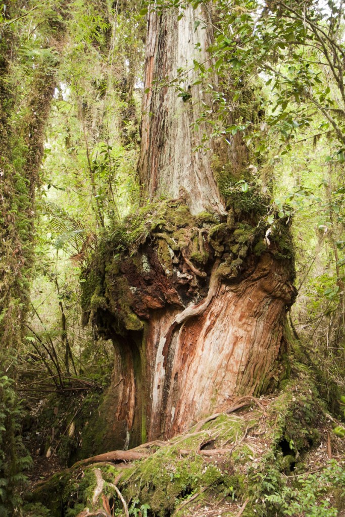
An alerce (larch) tree in Parque Pumalin, a rainforest. Photo © skopal/123rf.
Pumalín stretches from 42° south latitude, where it is contiguous with Parque Nacional Hornopirén, to nearly 43° south, east of Chaitén in the south. Most visitors see the areas along both sides of the Carretera Austral between Chaitén and Caleta Gonzalo.
Elevations range from sea level to snowcapped 2,404-meter Volcán Michinmahuida, in the southernmost sector, but even these statistics are misleading. The topography rises so steeply that some trails require ladders rather than switchbacks. The forests owe their verdant color to rainfall that probably exceeds 4,000 millimeters per annum. At higher elevations, of course, it accumulates as snow.
From a trailhead near Café Caleta Gonzalo, the Sendero Cascadas climbs and winds through thick rainforest to a high falls; figure about 1.5 hours each way. At the Centro de Información, it’s possible to arrange a tour of the apiaries at Fundo Pillán, across the Fiordo de Reñihué, and to obtain fishing licenses.
From a trailhead about 12 kilometers south of Caleta Gonzalo, west of the highway, the Sendero Laguna Tronador crosses a pasarela (hanging bridge) before ascending a string of slippery stepladders to the Mirador Michinmahuida where, on clear days, a platform provides astounding views of the volcano’s wintry summit. The trail continues through nearly pristine forest, dropping gradually to the amphitheater lake where Tompkins’s staff have built a stylish two-site campground with picnic tables, a deck, and an outhouse. It’s about 1.5 hours to or from the trailhead.
A short distance farther south, on the highway’s east side, the mostly boardwalk Sendero los Alerces crosses the Río Blanco to a large alerce grove. Just a little farther south on the west side, the Sendero Cascadas Escondidas is longer and more strenuous than the signposted three hours might suggest. It’s mostly boardwalk, through the swampy, soggy forest, and catwalk along precipitous rock walls, with some steep stepladders as well. The toughest part, though, is boulder-hopping the river on slippery granite or, better and perhaps safer, wading across. On the other side, the trail climbs steeply another 15-20 minutes, then drops into a narrow canyon where, on a dangerous-looking stepladder anchored by a rope, the bravest hikerscan circle the rock to get the best view of the “hidden” falls.
Seventeen kilometers south of Caleta Gonzalo, at its namesake campground, Sendero Lago Negro leads 800 meters through dense forest to reed-lined Lago Negro. Just north of the park entrance on the Chaitén-Caleta Gonzalo road, the Sendero Interpretativo is a 1.8-kilometer walk in the woods starting from the Volcán ranger station, which provides an explanatory map. From Chaitén, it’s possible to reach the southern Sendero Ventisquero Amarillo, via a northbound road at the highway’s junction of the turnoff to Termas El Amarillo.
Al Sur Expediciones (Aconcagua 8, Puerto Varas, tel./fax 065/2232300) arranges activity-oriented excursions—hiking, sea kayaking, and sailing— throughout the park.
Chiloé-based Austral Adventures (Av. Costanera 904, Ancud, tel./fax 065/2625977) offers customized cruises on the 15-meter motor vessel Cahuella.
There is now daily transportation to and from Puerto Montt via the Ruta Bimodal, which uses ferry crossings from Hornopirén to Leptepu and Fiordo Largo to Caleta Gonzalo. For passenger bus information, see the transportation entries for Puerto Montt or Chaitén. Vehicle space is limited, though, and requires reservations through Naviera Austral.
Excerpted from the Fourth Edition of Moon Patagonia.