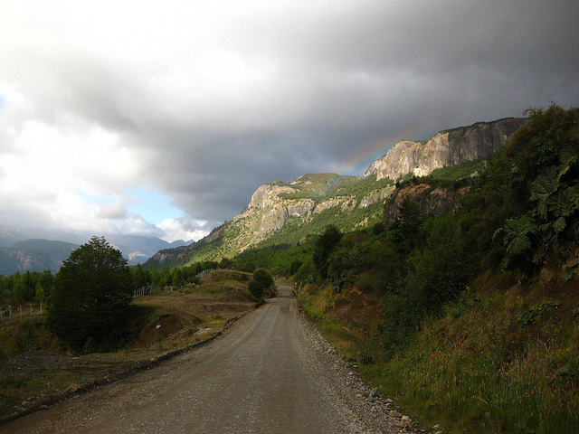
Along some sections of the Carretera Austral “highway” may be a misleading term. Photo © Mr Hicks46, licensed Creative Commons Attribution Share-alike.
Not so long ago, to visit northern Chilean Patagonia’s wild temperate rainforests, pristine lakes, rushing rivers, fathomless fjords, and sprawling ice fields with jagged glacial summits, you went by sea or air. Weekly ferries from Puerto Montt called at tiny ports like Chaitén and Puerto Puyuhuapi en route to Puerto Chacabuco, 80 km west of the regional capital of Coyhaique. Small planes and air taxis used grass or gravel airstrips at pioneer settlements like Chaitén, and only the smallest jets could land at Coyhaique’s airport because there wasn’t enough level ground to handle anything bigger. If you wanted to go overland, you went over bad Argentine roads.In the 1970s, though, Chile began a project to unite the sliver of the country that lies south of Puerto Montt via the Carretera Austral Longitudinal, a narrow, discontinuous, serpentine highway that now winds south to Villa O’Higgins, linking isolated hamlets over more than 1200 km. Steadily improving, this still rugged route, rarely wider than a single LA freeway lane, has begun to hook the handful of adventurous travelers who seek it out. It has brought an influx of foreigners like Esprit founder Doug Tompkins, who has created his own private national park; rafters and kayakers who have turned the tiny burg of Futaleufú into a burgeoning adventure center; cyclists and bikers en route to Tierra del Fuego, the tip of South America; and pods of budget travelers who join forces to rent pickup trucks in Santiago, Chile’s capital.
Near Coyhaique, the two-lane Carretera is wide and paved, but in some sections “highway” seems a misnomer for a precarious road that needs frequent grading to smooth spine-shattering washboard and countless potholes. In summer, highway crews hack back the wild vegetation that, left unchecked, would cover the road in a season or two. It’s no longer a 4WD road but, though there’s still more cow patties and road apples than blown tires, speeds more than 40 km per hour are often inadvisable.
Literally the biggest destination near Chaitén is Tompkins’ Parque Pumalín, an 800,000-acre private nature reserve that includes groves of the long-lived alerce (false larch), the Chilean redwood, north of Chaitén. Unfortunately, the 2008 eruption of Volcán Chaitén has closed this section of the highway, and most of the park, for at least the 2010 season.
That said, Naviera Sur ferries from Puerto Montt and Quellón (on the island of Chiloé) are still delivering motorists, motorcyclists, bicyclists, and even pedestrian passengers to Chaitén, which has been largely evacuated though some accommodations remain open and bus service south to Coyhaique continues. Sights and attractions along or near the route include the whitewater rafting and kayaking Mecca of Futaleufú; Parque Nacional Queulat, with its hanging glacier; the Termas de Puyuhuapi hot springs; the city of Coyhaique itself; Parque Nacional Laguna San Rafael, where the ice meets the sea; the pinnacles of Reserva Nacional Cerro Castillo, and the terminal town of Villa O’Higgins (where, however, it’s possible to continue by fjord and overland – on horseback and foot – to the Argentine trekking capital of El Chaltén.
For anyone who wants to drive the Carretera Austral, the long days of the southern summer are an ideal time. The simplest option is to fly into Coyhaique and rent a vehicle, heading either north or south, but this involves considerable backtracking to see the entire road. Reserving a car is essential in Coyhaique, which has a relatively small fleet of vehicles, well in advance.
It’s also possible to rent a vehicle in Puerto Montt, but this will mean either retracing the entire route, returning via Argentina (at extra cost for paperwork and insurance), or expensive dropoff charges in Coyhaique (the only option along the highway).
Anyone driving the Carretera Austral’s should be aware of its hazards. There is relatively little traffic, but in many areas it is narrow, with a high center and sloping sides, little or no shoulder, and many blind curves – sound the horn at every opportunity. 4WD is not essential, but high clearance is advisable even if some drivers now do the route in a normal passenger car.