From the cliff-hanging trails of Amalfi to the colossal granite spires of the Dolomites, volcano climbs in Sicily to hikes deep into the heart of the flower-freckled Appenines – Italy is a boot made for walking.
Start/End: Valnontey | Distance: 20.5km | Length: 9½-10 hours | Difficulty: demanding
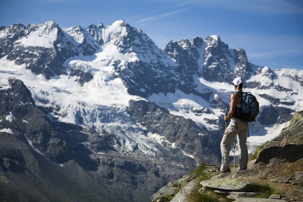
The Parco Nazionale del Gran Paradiso in the Graian Alps is a staggering wilderness of jewel-coloured lakes, forests and some of Italy's highest mountains, including its eponymous 4061m peak. This classic hike takes you right to its heart. From the town bridge in Valnontey, the Alta Via 2 leads on an old mule trail uphill to 2588m Rifugio Sella, a former hunting lodge of King Vittorio Emanuele II. Between here and Casolari dell'Herbetet, a park ranger's base to the south, hikers will find a short, airy traverse with a length of chain for protection.

The day's ascent is 1180m and the trip is virtually downhill all the way back to the village from the casolari. The views across the valley are simply breathtaking: spiky peaks, small glaciers lining the eastern skyline, and the mighty Ghiacciaio Tribolazioni below Gran Paradiso itself. Herds of ibex and chamois graze peacefully on steep patches of grass and you should also hear and see marmots. Only tackle this one on a clear day – you’ll need to be surefooted and have a head for heights.
Start: Riomaggiore | End: Monterosso | Length: 12km | Duration: 3-4 hours | Difficulty: easy-moderate
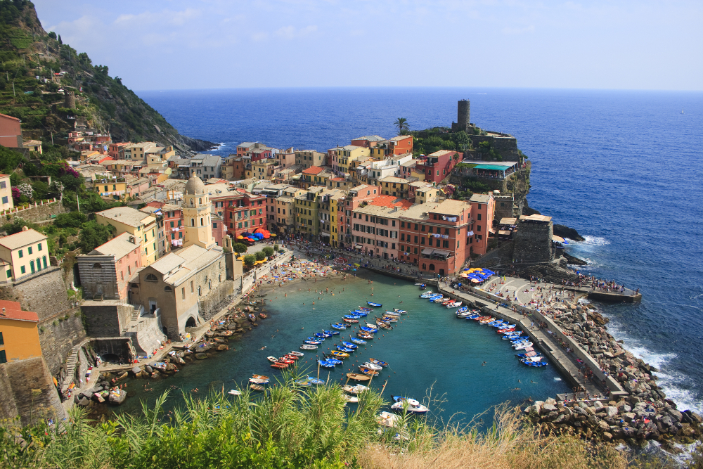
Yes, Cinque Terre really is as jaw-dropping as the photos you’ve seen. The five preposterously perched fishing villages in ice-cream colours look as though they’ll topple off the cliffside with the merest puff of wind. The Sentiero Azzurro (Blue Trail, marked No. 2 on maps) strings them all together, teetering past vines, olive groves and terraced hillsides, hugging the contour of the coastline cliffs along the sapphire Ligurian Sea.

The route is best walked east to west, from Riomaggiore to Monterosso, and if you're not up for doing the whole thing, you can walk as far as the middle village, Corniglia, and get a train back. Before you head off, make sure you get a Cinque Terre Card for updates on trail conditions.
Start: Pedra Longa | End: Cala Fuili | Length: 45km | Duration: four to seven days | Difficulty: very demanding
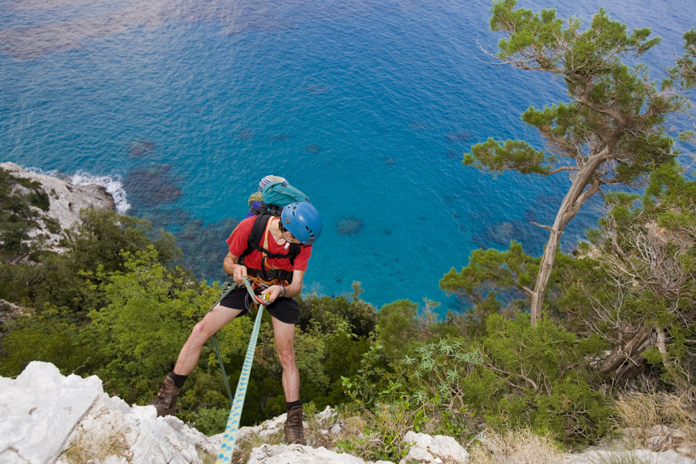
Often hailed as Italy's toughest trek, the Selvaggio Blu , or the 'Wild Blue', isn't for the faint-hearted. Threading its way along the Golfo di Orosei on Sardinia's east coast, this is an epic, off-the-radar trek that requires mountaineering experience. Signs and water are desperately lacking, trail finding is tricky (even with GPS) and the going can be tough with abseils of up to 45m and UIAA grade IV+ climbs.

But it's worth it. The multi-day hike takes you along one of Italy's wildest and most isolated coastlines, with deep gorges, impenetrable vegetation, cliffs dipping up to 800m and unrivaled views of the Mediterranean. Old shepherds' and charcoal burners' paths weave past silent coves and dramatic overhangs. Unless you are familiar with these parts, however, you're going to need a guide – try climbing and hiking guru Corrado Conca .
Start/End: Rifugio Auronzo | Length: 9.5km | Duration: three to four hours | Difficulty: moderate
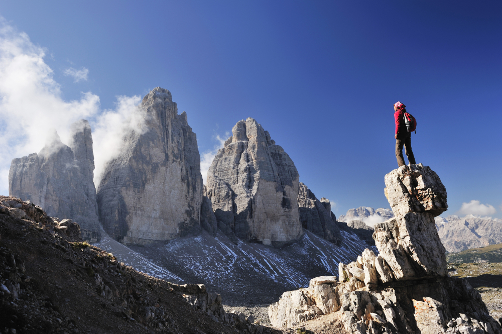
Madre Natura was generous with Italy in the looks department, but she surpassed herself in the Dolomites. The cloud-scraping spires and limestone towers that fling up above meadows, lakes and spruce forests in the country's northeast offer some of Europe's most compelling walking country. If you're going to do just one day hike here, make it the Tre Cime di Lavaredo Circuit in the Parco Naturale delle Dolomiti di Sesto.

The trail weaves to Rifugio Lavaredo , then climbs up to Forcella di Lavaredo (2454m) with pop-up views of the Tre Cime – a trilogy of photogenic peaks shaped like bishops' mitres, before heading on to Rifugio Locatelli and back to Rifugio Auronzo to continue any higher.
The best seasons for hiking are spring and early autumn, though the window is shorter in the Alps and Dolomites (late June through September). Bear in mind that most Italians holiday in August, so trails are at their most crowded and rifugi are usually booked solid that month.
Most local and regional tourist office websites provide information about walking in their area. The Italian Parks organisation lists walking trails through each of the country’s 24 national parks. Italy’s major walking club, the Club Alpino Italiano lists rifugi (mountain huts) and details on trail routes. Tabacco produces a decent range of topographic 1:25,000 hiking maps.