Soak up the sun and glorious sea views from these little-known beaches in south-west UK – perfect for weekend trips this summer
Land's end and the lizard
A wide slice of golden sand that has plenty of places to sit or stroll even at high tide, Gwynver makes a peaceful alternative to next-door Sennen Cove. Just across the water from Land’s End, it offers stunning views of its noisy neighbour and Longships Lighthouse over Whitesand Bay.
It’s certainly isolated. Even getting to the nearest shop and toilet requires waiting for low tide and then walking across the sands to Sennen.
Getting there: Take the A30 towards Land’s End. Then on a left-hand bend, just after the junction with the B3306, take the small road on the right. Bear right when the road splits after 100 metres or so, and keep going until you see signs for a car park.
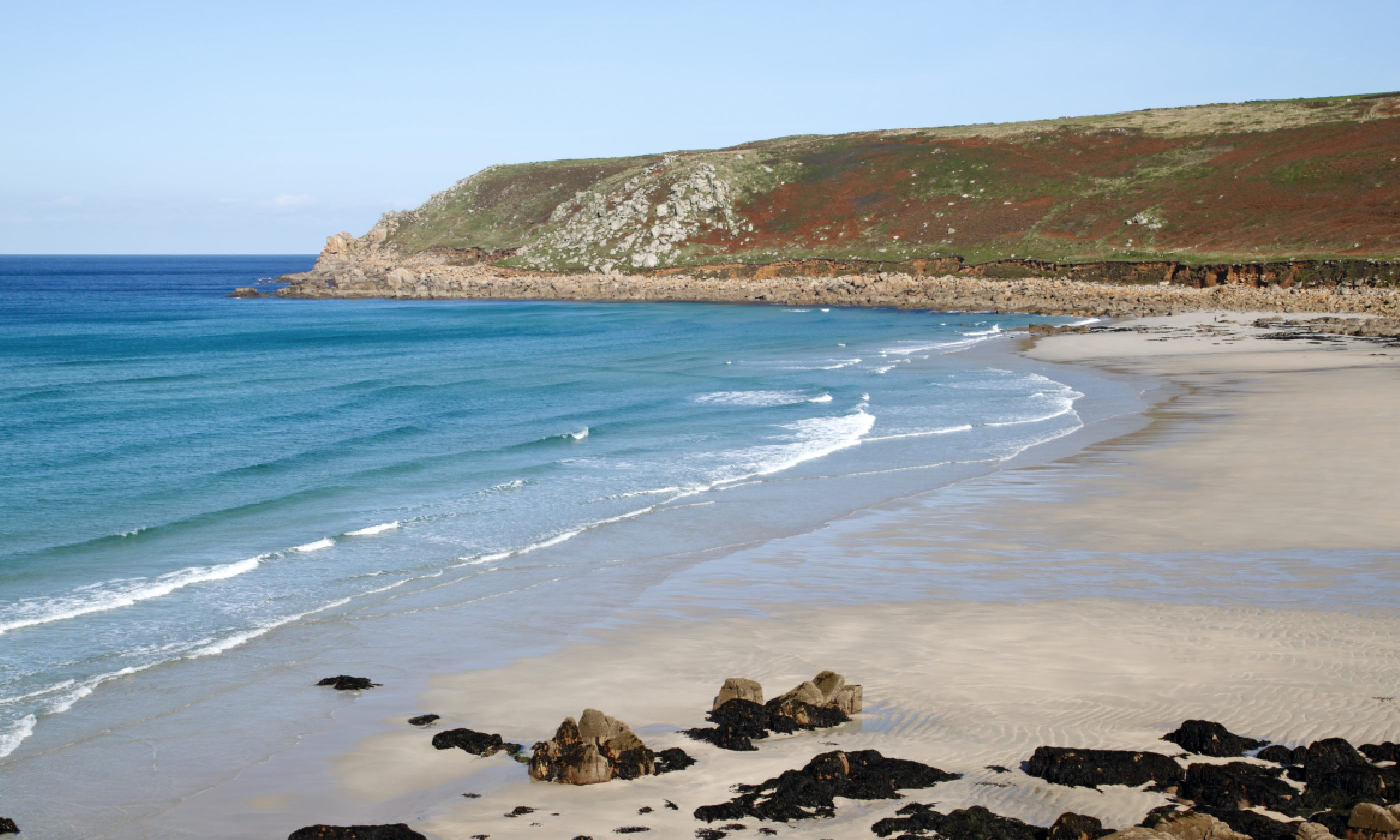
Gwynver Beach
Distance: 1.2km
Duration: 20 minutes
Walk grade: Easy
Beach access: Easy
1. From the top car park, follow the path that begins opposite the layby on the road. This leads down steep steps for around 10 minutes to Gwynver.
2. If you’re beginning the walk in the lower car park, you can join the path at the point where it runs adjacent to the bench and picnic table.
3. Once you’ve reached the beach, you can return via the same steps. Be warned; as it’s more than a 70-metre ascent from the shoreline to the car park, this can feel like hard-going.
Land's end and the lizard
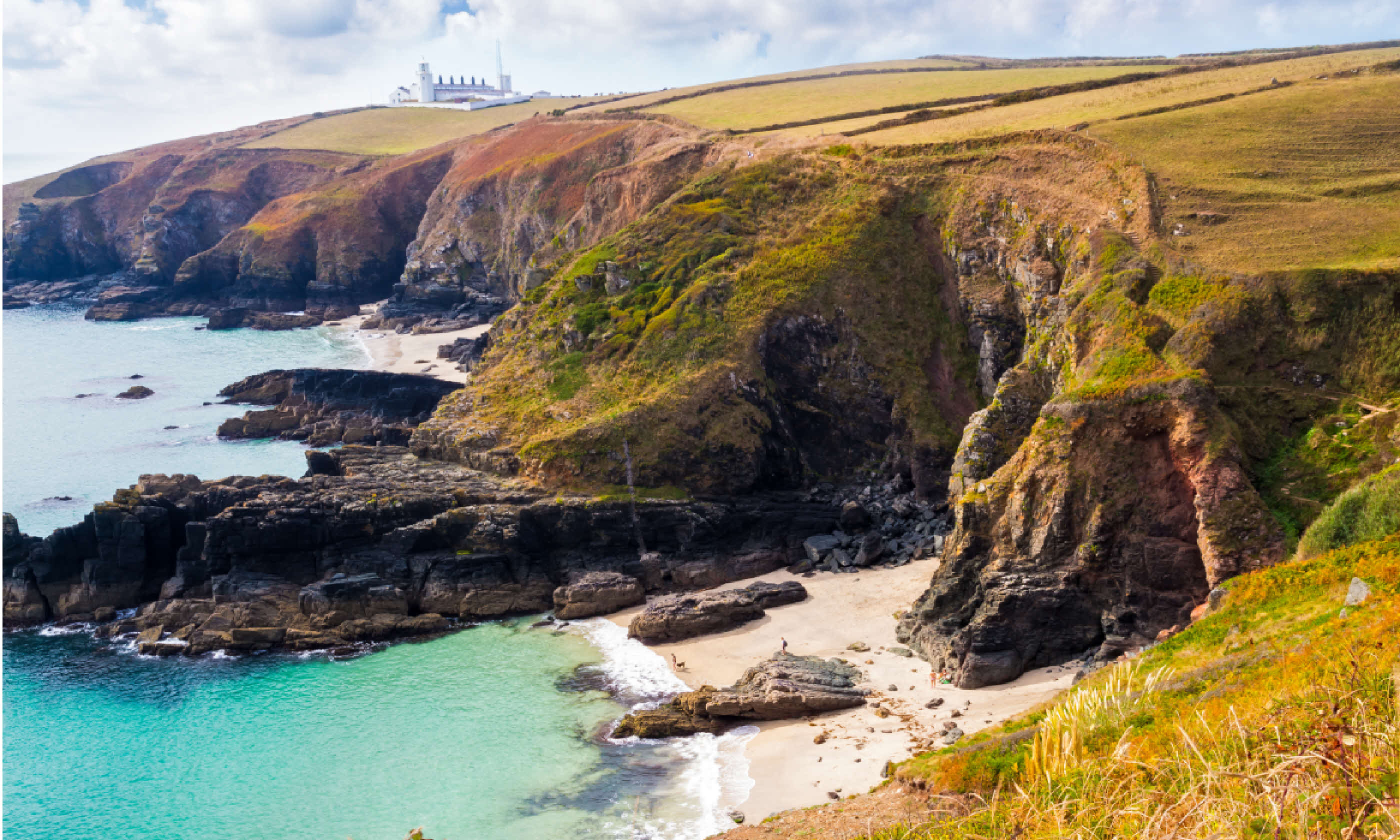
The walk we’ve suggested here, around the Lizard Point, is the longest for good reason. The full 15-kilometre route takes you around the most southerly parts of the British mainland, and past Kynance Cove – one of Cornwall’s most spectacular and popular coastal stretches. Housel Cove and Pentreath Beach are stunning alternatives to the people-packed sands of their near-neighbour.
At low tide, pretty Housel – located at the base of a steep valley – rolls out like a carpet towards the blue waters of the bay, while Pentreath rivals the famous surf spots of Fistral and Porthtowan in the amount of Atlantic swell that rears up before it.
Don’t let the length of our suggested walk put you off. The only hill worth worrying about is just after Church Cove at the beginning, and the rest of the route is flat. And, as you’re never more than 20 minutes from your starting point in Lizard village, you’re under no obligation to do the walk in its entirety. We recommend that you do, though…
Getting there: Head south on the A3083 into Lizard village and park on the green in the centre (postcode: TR12 7NQ).
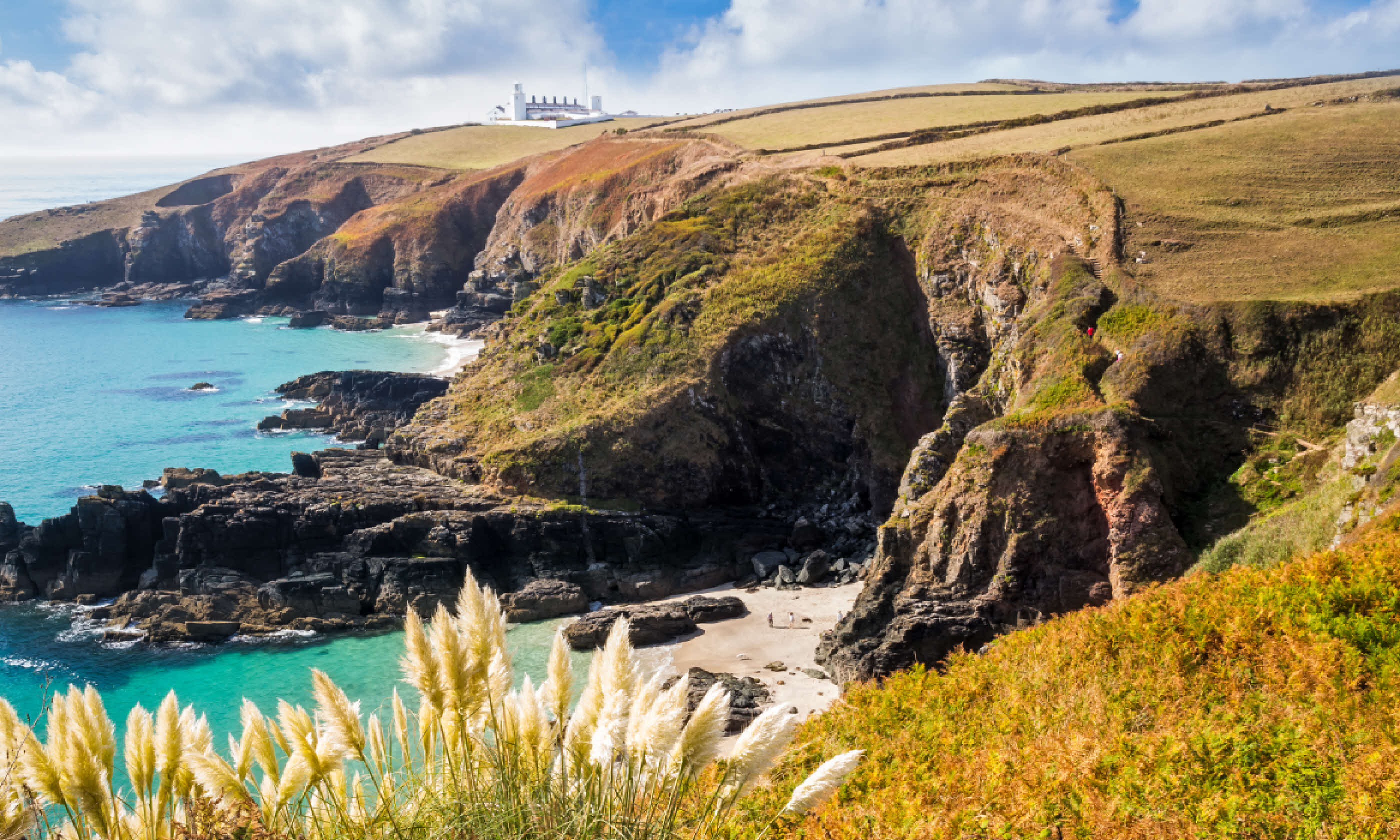
Housel Bay (Shutterstock)
1. From the car park, follow signs down the lane to Church Cove. Walk all the way down to the Coastal Path and turn right.
2. Follow the path for 45 minutes or so, past the lifeboat station and the Housel Bay Hotel. When you reach the bottom of a steep valley, turn left and descend the steps to Housel Cove.
3. To continue on to Pentreath Beach, carry on along the Coastal Path. This takes you past the lighthouse and, around 30 minutes later, to the tip of the Lizard – the most southerly point in mainland Britain. There’s a café serving good cream teas here, and an honesty-box shop at which you can pick up some jam for your own homemade version.
4. Continue along the path and, 50 minutes or so later, you will reach Pentreath Beach. At the time of writing, the steps down to the beach were closed because of erosion, but the local council have plans to fix this.
5. If the steps are inaccessible, the only way down to the beach is via a steep and precarious path that threads through loose rock. You can find it on the far side of the beach as you walk along the Coastal Path. Take care if you do decide to go down – and make sure you’re wearing suitable shoes.
6. To continue with our suggested route, return to the Coastal Path and carry on walking along. After around 10 minutes, you will see the beautiful Kynance Cove. To get down to it, take the access path that leads straight ahead.
7. To return to your car, head for the viewpoint above Kynance Cove then walk back through the car park behind you. Go up the lane and, at the first sharp bend around 400 metres in, turn onto the pathway that leads straight ahead into the fields. Follow this for 15 minutes or so back to Lizard village.
South Devon
Sunset is the perfect time to visit this secluded cove, which sits beneath the looming crags of Bolt Head. Tombstone-like rocks dot the wide tranche of golden sand, casting shadows across its flat expanse as day ebbs away, while the last rosy fingers of sunlight shimmer in the surfaces of rockpools.
The beach is accessed from the Coastal Path. Our suggested walk takes in one of Devon’s most spectacular sections of coastline – which can feel fairly demanding in places – but those with children needn’t worry. The beach itself is only a short stroll from the car park.
Getting there: Head south on the A381 to Malborough. Once you’ve reached the town, take the right turn signposted Bolberry. Drive along this road, following signs to Soar and then the Soar Mill Cove Hotel. The car park is situated on the left, just before the hotel.
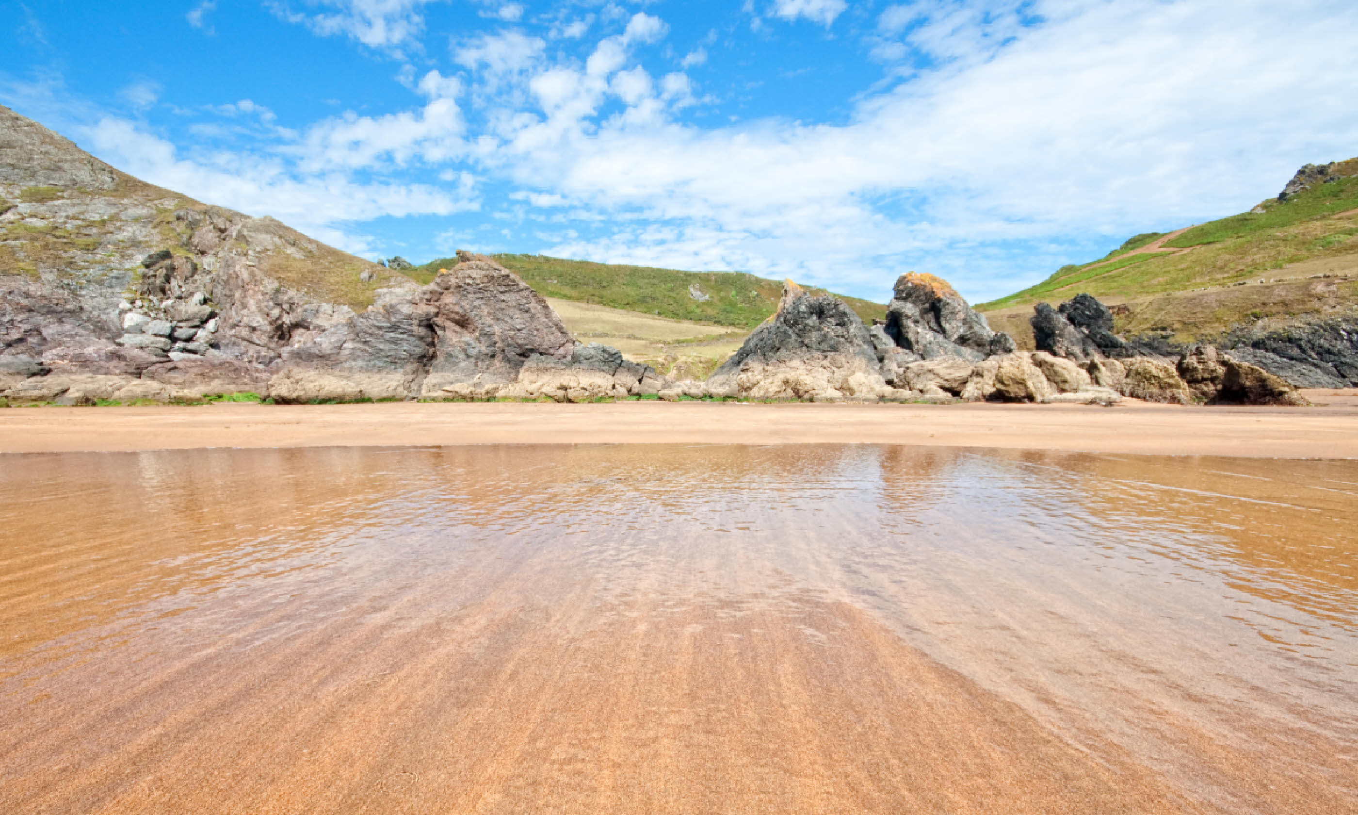
Soar Mill Cove (Flickr C/C: Peter Castleton)
Distance: 4.5km
Duration: 1 hour 30 minutes
Walk grade: Moderate
Beach access: Easy
1. Walk out of the car park and head left down the hill. Climb over the stile at the bottom and walk straight down through the fields to the beach. This should take around 10 minutes.
2. Returning from the beach, you have two options. You can either retrace your steps back to the car park or continue on our suggested walk. If you choose the latter, head over the wooden footbridge behind the beach and follow the Coastal Path eastwards around the headland.
3. After you climb over the second of two stiles, you will find yourself in a valley. When you reach the top of the other side, bear left along the wider path that leads inland.*
4. Walk along until you come to a signpost. Head in the direction of Malborough and Lower Soar, taking the path that runs through fields next to a tall farm building. Pass through three fields.
5. At the stile that leads out of the third field, you’ll see the car park down in the valley to your left. Follow the path to your right, though, which winds around to the road.
6. Once you’re back on the road, turn left to get to the car park.
*There are many paths in this area. They criss-cross and you will have to use your sense of direction to find your way. Look for the tall farm building as a marker.
North Devon
The cliffs along the Exmoor coastline, particularly those east of Lynmouth, are among the highest in the country. And this can lead to some long and arduous descents to its beaches. This is certainly true of Woody Bay, though this stunning stretch of shoreline more than compensates for any aching shins.
The beach is gorgeous at every level – densely wooded hills plummet down to huge rock buttresses, flat sandy plains and, finally, the Atlantic, and the views are exceptional. Our suggested walk follows a leafy lane through picture-postcard cottages, and past moss-bordered waterfalls and ancient bridges down to the sea.
Getting there: Head west out of Lynton on the road that takes you through the Valley of Rocks. Drive past Lee Bay and keep going along the clifftop road. Around 300 metres after the Woody Bay Hotel, you’ll see a parking area on the left where you can leave your vehicle.
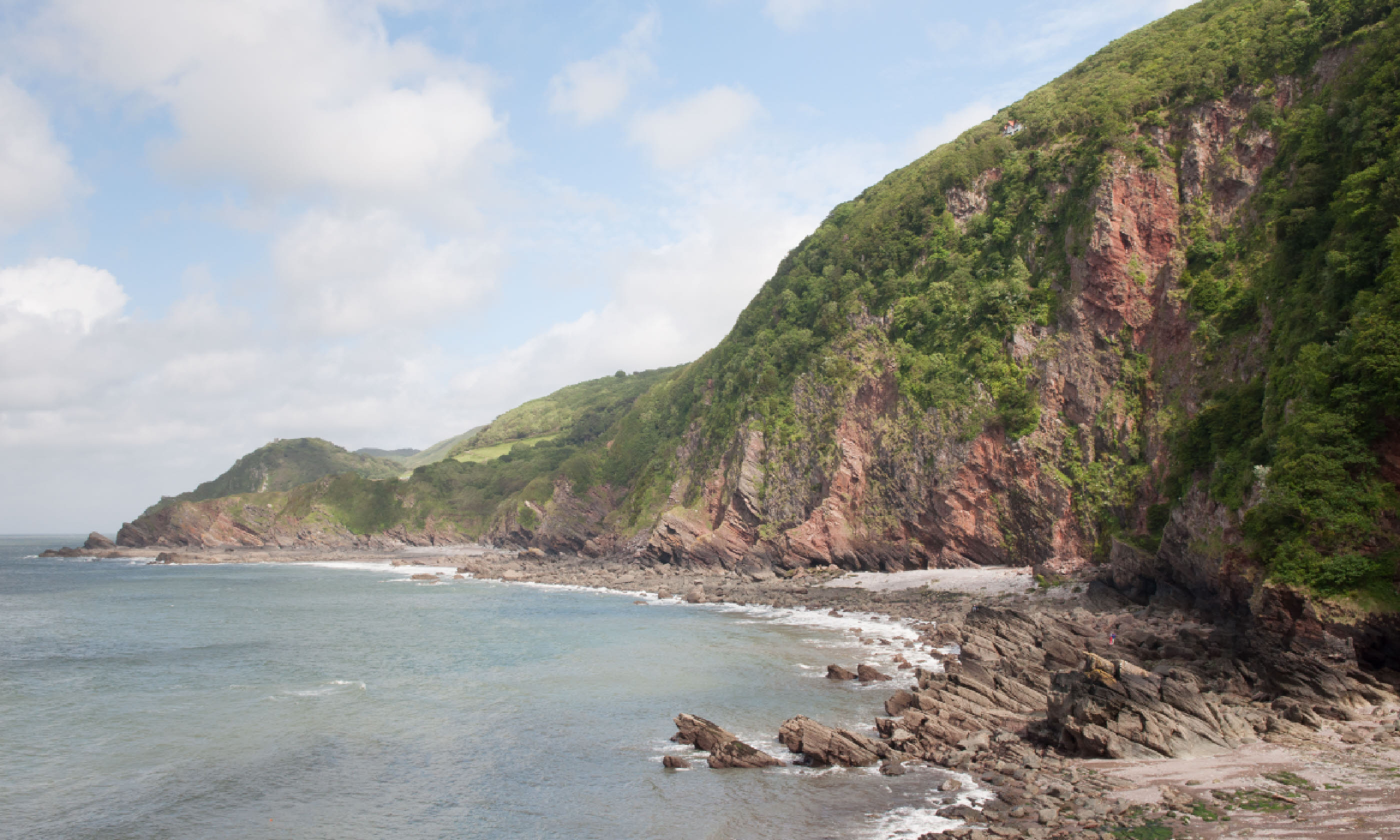
Woody Bay (Flickr C/C: Jojo 77)
Distance: 2.5km
Duration: 45 minutes
Walk grade: Moderate
Beach access: Easy
1. Exit the car park and walk downhill, past the Woody Bay Hotel, into the wooded valley.
2. Just before the road starts going uphill again, you will see a gate on your left. Go through here and follow the track into the woods.
3. Turn right onto a lane after 10 minutes or so, and follow it all the way down to the beach.
4. To continue with our suggested circular route, walk back up the lane from the beach, past the point at which you joined it.
5. When you reach the road at the top, turn right and you will see the parking area ahead of you.
North Cornwall
A wide crescent of sand, spliced in two by a mussel-crusted spike of rock, Fox Cove is the largest of the three inlets that sit between Treyarnon Bay and Porthcothan. Completely inaccessible at high tide, the beach reveals its smooth, butter-yellow sweep when the water retreats, and the deserted shore presents a glorious alternative to all the sun-seeking and sandcastle-digging going on at neighbouring Porthcothan.
Our suggested walk takes you along a gently undulating clifftop path and past the wave-pounded Minnows Islands. The only challenge arises on the final part of the descent to the beach. Watch your footing.
Getting there: Take the B3276 south from St Merryn and, when you arrive in Porthcothan, park in the council car park. Charges vary, depending on the length of stay.
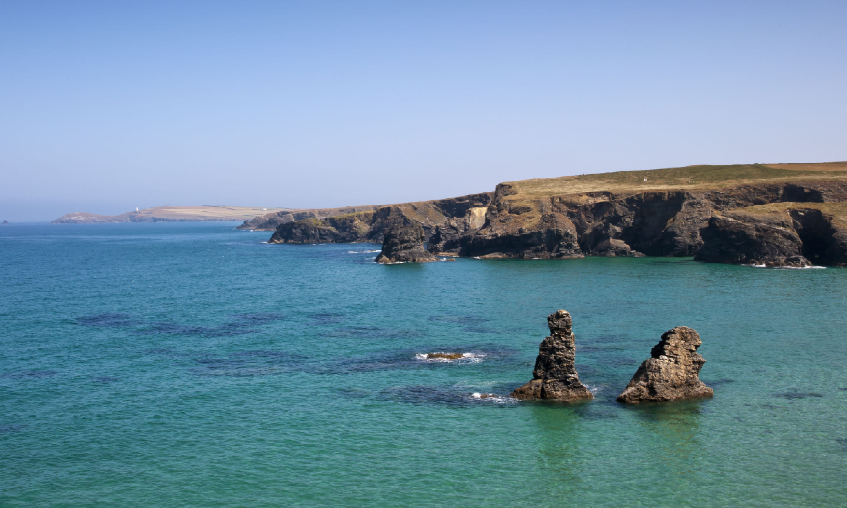
Porthcothan beach
Distance: 5km
Duration: 1 hour, 15 minutes
Walk grade: Easy
Beach access: Extreme
1. Turn right on the road outside the car park. You’ll see Porthcothan Beach immediately on your left. To get to Fox Cove, cross the bridge and take the track on the left.
2. Walk for 50 metres or so up the headland and join the Coastal Path on the right. At the crossways, go straight ahead. This track will take you north along the cliffs, and past Minnows Islands.
3. After walking for around 25 minutes, you will arrive at the area behind Fox Cove, which is home to an RSPB reserve and a campsite. The access path down to the beach is on the far side, on the left near a bench.
4. When the path splits halfway down, take the left-hand fork. This precarious route winds down to some rocks. Scramble over these to the sand. Take care.
5. To return to your car, simply retrace your steps.
North Cornwall
A secluded corner of the spectacular yet popular Bedruthan Steps, Diggory’s Island Sand is only accessible from the beach at low tide. To visit its arc of pale-gold sand at any other time requires following our suggested walk around Park Head, and watching your footing as you edge your way down to the deep-blue lagoons around its shoreline.
Getting there: Head north out of Mawgan Porth on the B3276, and drive past the two car parks that serve the Bedruthan Steps. Continue along the flat road and, just as you start to go downhill, look out for Park Head car park, which displays a National Trust sign.
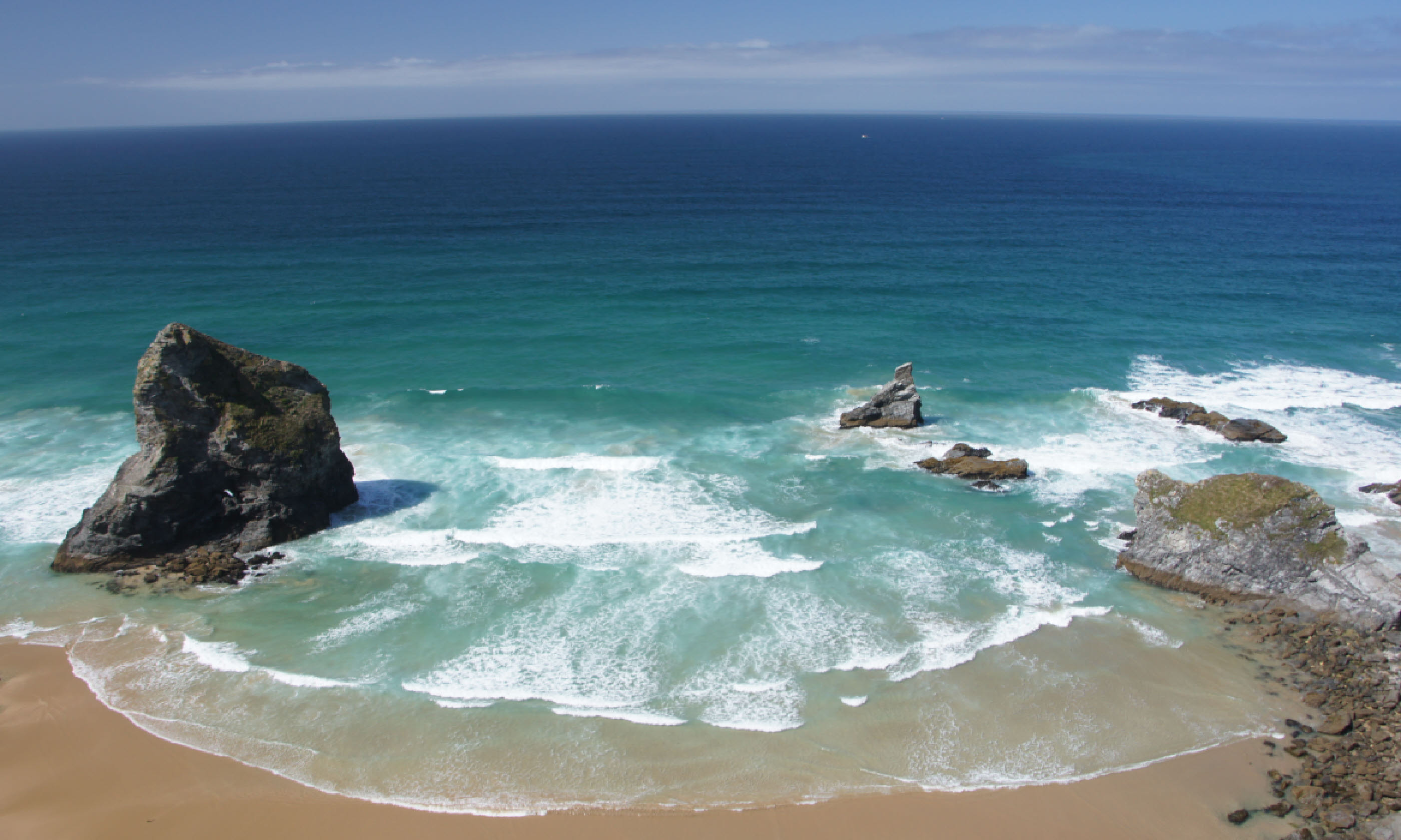
Bedruthan Steps (Flickr C/C: Martin Abegglen)
Distance: 3.5km
Duration: 1 hour
Walk grade: Moderate
Beach access: Difficult
1. Walk out of the other end of the car park from the one you came in on and head left along a path that takes you through fields.
2. Turn left at the signpost, and follow the path all the way down to the coast.
3. Look out for the access path to the beach on your left. This leads you down the sloping headland for around 100 metres to some precarious-looking rocks, which you must scramble down to get to the sand.
4. To continue with our suggested route, climb back up to the path and head left. Follow the network of paths that hug the cliff-edge, and look down on the coves and lagoons that emerge between the jagged rocks and islands.
5. Continue around the headland until the paths merge to descend into Porth Mear. You can swim out to explore the islets and sea caves from this point.
6. To carry on towards the car park, take the path on the right before the footbridge. This leads you through a conservation area into a field. Head uphill here and around the back of a farmhouse. Turn left along the lane, and you will arrive back at your car in a few moments.
Jurassic Coast
Quite how White Nothe Beach came to exist isn’t really clear. A small area of boulder-surrounded pebbles, situated to the east of Weymouth, it is little more than a collection of stones that happens to have accumulated in one place.
Our challenging suggested walk takes in part of beautiful Ringstead Bay – so, if White Nothe Beach has finally given in and returned to the sea by the time you get there, you’re guaranteed at least one pretty shore on which to pause. The walk also provides great views across Weymouth harbour to Portland, as well as of towering White Nothe.
Getting there: Head southeast out of Dorchester on the A352 and turn right onto the A353. Go through Poxwell, then turn left onto the road to Upton and Ringstead just after the bend. Follow this all the way to the headland, over the cattle grid and into the National Trust car park.
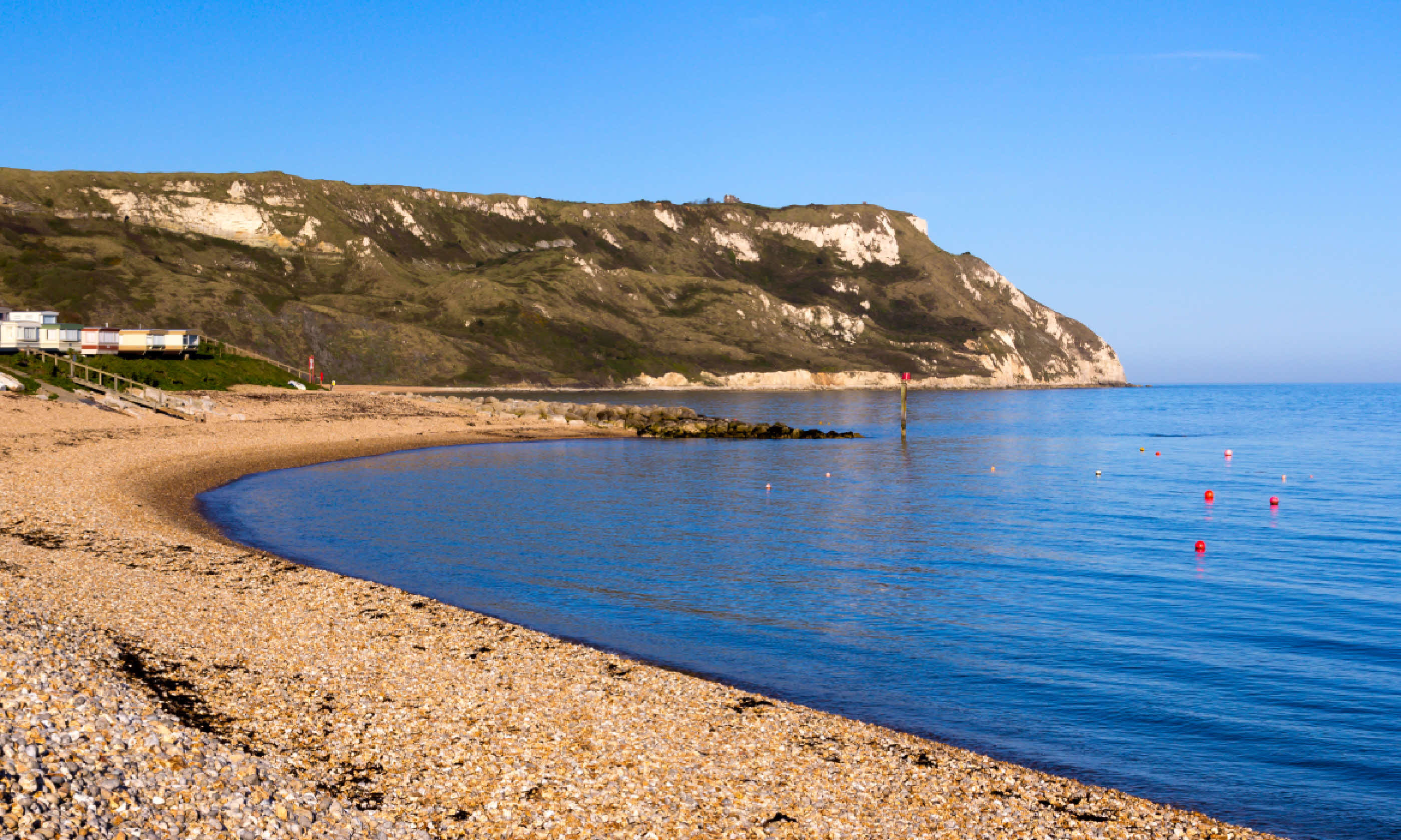
Ringstead Bay (Shutterstock)
Distance: 7.5km
Duration: 1 hour, 45 minutes
Walk grade: Difficult
Beach access: Moderate
1. Exit the car park at the far end and follow the track. When it splits, take the left-hand fork, then turn left onto the Coastal Path after around 100 metres.
2. Follow the Coastal Path up to the top of Burning Cliff and along to White Nothe Cottages. Take the right-hand fork here, then turn right along Smuggler’s Path.
3. White Nothe Beach comes into view once the path starts to flatten out, and the access path is situated on the left just before a dip. You will need to scramble down for a couple of metres, but it’s nothing too risky.
4. To continue with our suggested route, carry on along Smuggler’s Path to the shoreline. The first part is fairly hard-going, and simply isn’t possible at high tide. The second is easier, and takes you along Ringstead Bay.
5. Walk to the far side of Ringstead Bay beach and take the road that leads inland. You will pass the Ringstead Bay Kiosk after around 100 metres.
6. Continue up the road, then take the right-hand path on the first bend. Go over two stiles and a footbridge, and follow the somewhat indistinct path up the side of the valley and then on through fields past South Down Farm.
7. Keep right and follow the path up the steep gradient. You will see the car park as the path starts to flatten out.
 Extracts taken from Rob Smith's book Secret Beaches South-West. Check out his website for more details or to nab yourself a copy.
Top 13 things to do in Cornwall this summer | Inspire me... More
10 best places to learn to surf | Inspire me... More
Top 10 cool campsites in England | Inspire me... More
Top 5 UK glamping sites | Inspire me... More